
")

Die Tour startet und endet in Bad Wiessee. Die Buchsteinhütte ist das Ziel der Tour.
An der Abzweigung (Bild Nr.1) kann auch direkt die Schwarzentenn Hütte angesteuert werden.
Der sehr steile Anstieg zur Buchsteinhütte ist so zu vermeiden.
Empfohlene Einkehrmöglichkeiten
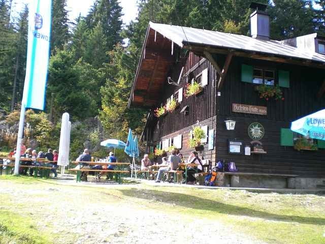
- Buchsteinhütte
- Cafe direkt am Tegernsee
Viel Spaß!
An der Abzweigung (Bild Nr.1) kann auch direkt die Schwarzentenn Hütte angesteuert werden.
Der sehr steile Anstieg zur Buchsteinhütte ist so zu vermeiden.
Empfohlene Einkehrmöglichkeiten
- Buchsteinhütte
- Cafe direkt am Tegernsee
Viel Spaß!
Galerie du tour
Carte du tour et altitude
Minimum height 693 m
Maximum height 1285 m
More about the tour author

|
Commentaires

- Von München Ausfahrt Holzkirchen bis nach Gmund
- In Gmund rechts Richtung Bad Wiessee abbiegen (Ampel)
- Am Ortseingang von Bad Wiessee rechts in die Jägerstraße abbiegen. Hier stehen kostenlose Parkplätze zur Verfügung.
- In Gmund rechts Richtung Bad Wiessee abbiegen (Ampel)
- Am Ortseingang von Bad Wiessee rechts in die Jägerstraße abbiegen. Hier stehen kostenlose Parkplätze zur Verfügung.
Tracks GPS
Trackpoints-
GPX / Garmin Map Source (gpx) download
-
TCX / Garmin Training Center® (tcx) download
-
CRS / Garmin Training Center® (crs) download
-
Google Earth (kml) download
-
G7ToWin (g7t) download
-
TTQV (trk) download
-
Overlay (ovl) download
-
Fugawi (txt) download
-
Kompass (DAV) Track (tk) download
-
Feuille de tours (pdf) download
-
Original file of the author (gpx) download
More about the tour author
|
|
Add to my favorites
Remove from my favorites
Edit tags
Open track
My score
Rate