


Asphalt, Schotter, Feld- und Waldwege, Single Trails
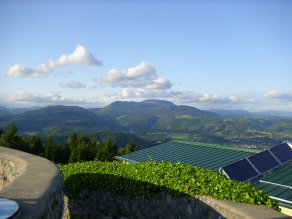
Abfahrt Single Trail vom Fürstenstand/Plubatsch setzt Erfahrung voraus,alternativ dazu Asphalt parallel
Start in Unterpremstätten beim Urdlwirt, Aspahlt Richtung Seiersberg, anschliessend weniger befahrene Strasse bis Schloss Eggenberg. Dort Auffahrt zum Fürstenstand / Plabutsch, anschliessende Abfahrt über Single Trail Richtung Kernstockweg, auf Weg 6 Richtung St. Johann u. Paul, Weiter Weg 6 / 2b / 2 Steirischer Mariazeller Weg Richtung Tobelbad, von dort aus zurück nach Unterpremstätten
Galerie du tour
Carte du tour et altitude
Minimum height 337 m
Maximum height 751 m
More about the tour author

|
Tomdog |
Commentaires

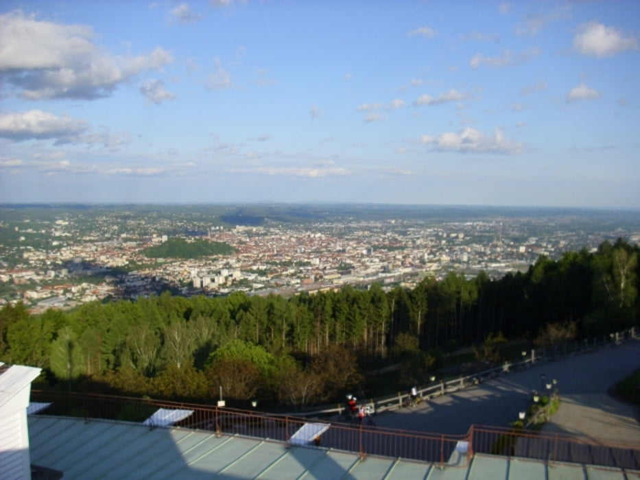
Unterpremstätten liegt südlich von Graz
Erreichbar über die Südautobahn A 2 oder Pyhrnautobahn A 9 Ausfahrt Unterpremstätten
Parkplätze im Ort oder in der Nähe vom Urdlwirt
Tracks GPS
Trackpoints-
GPX / Garmin Map Source (gpx) download
-
TCX / Garmin Training Center® (tcx) download
-
CRS / Garmin Training Center® (crs) download
-
Google Earth (kml) download
-
G7ToWin (g7t) download
-
TTQV (trk) download
-
Overlay (ovl) download
-
Fugawi (txt) download
-
Kompass (DAV) Track (tk) download
-
Feuille de tours (pdf) download
-
Original file of the author (gpx) download
More about the tour author
|
|
Tomdog |
Add to my favorites
Remove from my favorites
Edit tags
Open track
My score
Rate