Login

Login oublié ?

Cookies have to be accepted!
Your browser's cookie functionality is disabled. Please enable this functionality.

Not a member yet?

Register now
Login

Available for registred users only

Log in to use this feature.

Login oublié ?

Cookies have to be accepted!
Your browser's cookie functionality is disabled. Please enable this functionality.

Not a member yet?

Register now
Filter
Catégories
Advanced filters
  • Longueur (km)
  • Altimètre
Enregistrer le filtre Reset filter

TrackRank

QRCode

Technical data

Longueur17,0 km Altimètre282 m Way down290 m Durée04:00 h:m Date28.05.2010
Evaluations Author Paysage Aspect amusement Condition Technique

Statistiques

1347 Vues Evaluations 29 Téléchargements Moyenne
Rate
  • Feuille de tours
  • Arrivée
  • Téléchargements

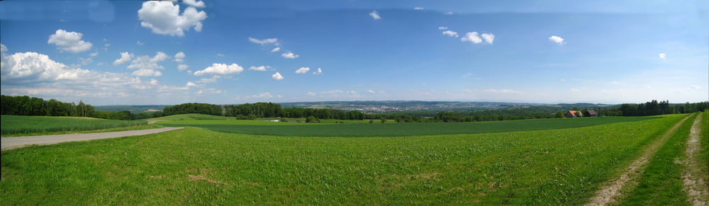
Von Weiler über das Kerner Tobel zum kleinen Schloss Benzenhofen, dann über das Kloster Kellenried nach Baienbach, dort einen Abstecher zum Bibersee (Badeeinlage!) und dann über Schnetzen mit dem wunderbaren Weitblick zurück nach Weiler.

Auch als nordic-walkining Runde gut geeignet.
Das Kerner Tobel ist zZ ziemlich blockiert durch umgefallene Bäume, deshalb nicht für MTB geeignet.


Galerie du tour

Carte du tour et altitude

  • Open Street Map
  • Google
Minimum height 457 m Maximum height 603 m Vue de détail

More about the tour author

wernermohr
Member since 2008

Send private message

Commentaires

Tracks GPS

Trackpoints
  • GPX / Garmin Map Source (gpx) download
  • TCX / Garmin Training Center® (tcx) download
  • CRS / Garmin Training Center® (crs) download
  • Google Earth (kml) download
  • G7ToWin (g7t) download
  • TTQV (trk) download
  • Overlay (ovl) download
  • Fugawi (txt) download
  • Kompass (DAV) Track (tk) download
  • Feuille de tours (pdf) download
  • Original file of the author (gpx) download

More about the tour author

wernermohr
Member since 2008

Send private message
Share track
Add to my favorites
Remove from my favorites
Edit tags
My score
Rate
Tour: Weiler, Kernen, Bibersee, Oberschwaben, 17km
Cat.: Randonnées
Longueur: 17,0 km
Evaluated on:
Durée:
Day(s)
Hour(s)
Minute(s)
Evaluation: Paysage Aspect amusement Condition Technique