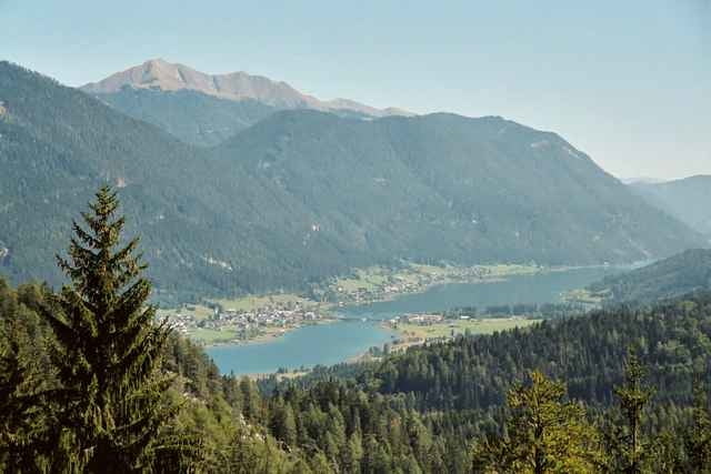
Vor dem Landhotel Die Forelle in Techendorf geht es los. Durch die Orte Gatschach und Oberdorf fahren wir vor bis kurz vor die OMV Tankstelle. Rechts abgebogen und dann geht es auch schon hinauf bis zur Weissen Wand - ein herrlicher Aussichtspukt. Der Weg führt uns weiter durch die unbewirtschaftete Gajacher Alm - wo man jedoch einen herrlichen Ausblick auf die Oberkärntner Berge genießen kann - bis hinunter zur Alm hintern Brunn - eine wunderschöne Almhütte.
Zurück am See heißt es dann nur mehr - ab ins erfrischende Weissenseewasser.
Zurück am See heißt es dann nur mehr - ab ins erfrischende Weissenseewasser.
Further information at
http://www.forellemueller.atCarte du tour et altitude
Minimum height 923 m
Maximum height 1510 m
Commentaires
Über Spittal - Greifenburg - Landhotel Die Forelle - gleich neben der evang. Kirche in Techendorf.
Tracks GPS
Trackpoints-
GPX / Garmin Map Source (gpx) download
-
TCX / Garmin Training Center® (tcx) download
-
CRS / Garmin Training Center® (crs) download
-
Google Earth (kml) download
-
G7ToWin (g7t) download
-
TTQV (trk) download
-
Overlay (ovl) download
-
Fugawi (txt) download
-
Kompass (DAV) Track (tk) download
-
Feuille de tours (pdf) download
-
Original file of the author (g7t) download
Add to my favorites
Remove from my favorites
Edit tags
Open track
My score
Rate


die Aussicht konnte ich wegen Regens nicht allzu sehr genießen. Die wenigen Lichtblicke ließen aber einige tolle Blicke vermuten. Als Verbesserung würde ich mir eine Trialeinlage wünschen.