Login

Login oublié ?

Cookies have to be accepted!
Your browser's cookie functionality is disabled. Please enable this functionality.

Not a member yet?

Register now
Login

Available for registred users only

Log in to use this feature.

Login oublié ?

Cookies have to be accepted!
Your browser's cookie functionality is disabled. Please enable this functionality.

Not a member yet?

Register now
Filter
Catégories
Advanced filters
  • Longueur (km)
  • Altimètre
Enregistrer le filtre Reset filter

TrackRank

QRCode

Technical data

Longueur9,1 km Altimètre48 m Way down45 m Durée01:45 h:m Date03.08.2010
Evaluations Author User Paysage Aspect amusement Condition Technique

Statistiques

1368 Vues 3 Evaluations 85 Téléchargements 3.33 Moyenne
Rate
  • Feuille de tours
  • Arrivée
  • Téléchargements

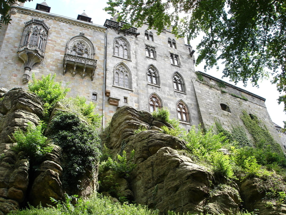
Bei dieser Wanderung geht man auf Wald- und Forstwegen durch das Kurzentum und vorbei am Höltingstuhl. Diese Wanderung nennt sich Badwanderung und ist in der Wanderkarte von Bad Bentheim mit einer 3 gekennzeichnet.


Galerie du tour

Carte du tour et altitude

  • Open Street Map
  • Google
Minimum height 39 m Maximum height 78 m Vue de détail

More about the tour author

rödivomsee
Member since 2008

Send private message

Commentaires

Parkplatz Bentheimer Mineral Therme am Bade 1

Tracks GPS

Trackpoints
  • GPX / Garmin Map Source (gpx) download
  • TCX / Garmin Training Center® (tcx) download
  • CRS / Garmin Training Center® (crs) download
  • Google Earth (kml) download
  • G7ToWin (g7t) download
  • TTQV (trk) download
  • Overlay (ovl) download
  • Fugawi (txt) download
  • Kompass (DAV) Track (tk) download
  • Feuille de tours (pdf) download
  • Original file of the author (gpx) download

More about the tour author

rödivomsee
Member since 2008

Send private message
Share track
Add to my favorites
Remove from my favorites
Edit tags
My score
Rate
Tour: Badwanderung
Cat.: Randonnées
Longueur: 9,1 km
Evaluated on:
Durée:
Day(s)
Hour(s)
Minute(s)
Evaluation: Paysage Aspect amusement Condition Technique