


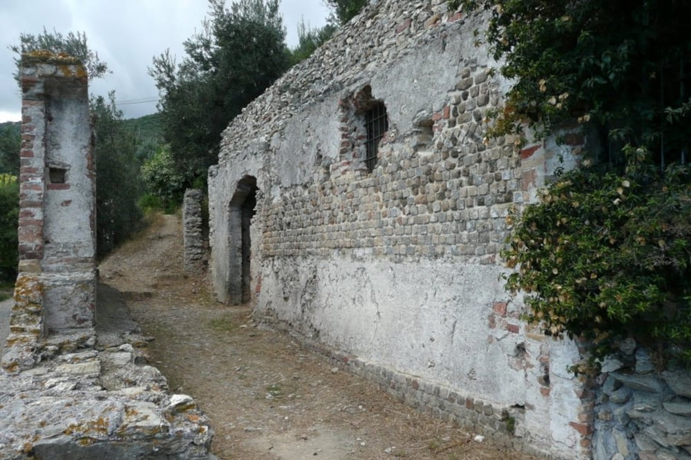
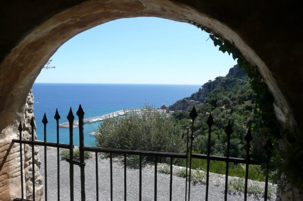
Der Sentiero Romano ist ein archäologischer Weg mit einigen Ausgrabungsstätten oberhalb der ligurischen Küste zwischen Albenga und Alassio. Er selbst verläuft ohne große Höhensprünge. Direkt beim Beginn des Pfads im Westen Albengas kann man sich abstellen. Am Ende des Pfads wartet eine kleine Kirche - knapp unterhalb dieser steigt dann der Weg zurück gut markiert an bis auf etwa 470 Hm. Wer will, kann noch den nicht sehr attraktiven Gipfel Monte Bignone (520 Hm) ersteigen. Beim Anstieg hat man fantastische Blicke aufs Meer! Wer nicht ganz zum Gipfel will, kann nach etwa 2/3 des Anstiegs nach rechts in einen deutlichen Pfad abbiegen, der mit einer Wellenlinie markiert ist.
Galerie du tour

Carte du tour et altitude
Minimum height 10 m
Maximum height 453 m
More about the tour author

|
schoenbli |
Commentaires

In Albenga die kleine Centa-Brücke überqueren. Am Ende der Via Ruffini (nach der Brücke rechts) sieht man bereits eine Tafel zum Pfad. Der Pfad selbst steigt dann (in der nächsten Querstraße nach rechts abbiegen) steil aus der Via san Calogero an. Über die S-Kurve hoch - der Weg geht dann sofort links los - ein Stückchen weiter parken.
Tracks GPS
Trackpoints-
GPX / Garmin Map Source (gpx) download
-
TCX / Garmin Training Center® (tcx) download
-
CRS / Garmin Training Center® (crs) download
-
Google Earth (kml) download
-
G7ToWin (g7t) download
-
TTQV (trk) download
-
Overlay (ovl) download
-
Fugawi (txt) download
-
Kompass (DAV) Track (tk) download
-
Feuille de tours (pdf) download
-
Original file of the author (gpx) download
More about the tour author
|
|
schoenbli |
Add to my favorites
Remove from my favorites
Edit tags
Open track
My score
Rate