


Nette Runde um Tuttlingen über 4 Berge.
Von Wurmlingen zum Hirschbrünnele, über Möhringen auf den Witthoh, weiter nach Nendingen, und noch auf den Rußberg rauf.
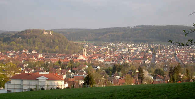
Dabei immer wieder schöne Aussichten ins Donautal.
Von Wurmlingen zum Hirschbrünnele, über Möhringen auf den Witthoh, weiter nach Nendingen, und noch auf den Rußberg rauf.
Dabei immer wieder schöne Aussichten ins Donautal.
Galerie du tour
Carte du tour et altitude
Minimum height 641 m
Maximum height 857 m
More about the tour author

|
W.Mayer |
Commentaires

Parken z.B. an der Elta Halle in Wurmlingen
Tracks GPS
Trackpoints-
GPX / Garmin Map Source (gpx) download
-
TCX / Garmin Training Center® (tcx) download
-
CRS / Garmin Training Center® (crs) download
-
Google Earth (kml) download
-
G7ToWin (g7t) download
-
TTQV (trk) download
-
Overlay (ovl) download
-
Fugawi (txt) download
-
Kompass (DAV) Track (tk) download
-
Feuille de tours (pdf) download
-
Original file of the author (gpx) download
More about the tour author
|
|
W.Mayer |
Add to my favorites
Remove from my favorites
Edit tags
Open track
My score
Rate