Login

Login oublié ?

Cookies have to be accepted!
Your browser's cookie functionality is disabled. Please enable this functionality.

Not a member yet?

Register now
Login

Available for registred users only

Log in to use this feature.

Login oublié ?

Cookies have to be accepted!
Your browser's cookie functionality is disabled. Please enable this functionality.

Not a member yet?

Register now
Filter
Catégories
Advanced filters
  • Longueur (km)
  • Altimètre
Enregistrer le filtre Reset filter

TrackRank

QRCode

Technical data

Longueur9,3 km Altimètre300 m Way down300 m Durée01:00 h:m Date20.02.2011
Evaluations Author Paysage Aspect amusement Condition Technique

Statistiques

2151 Vues 2 Evaluations 329 Téléchargements 5.00 Moyenne
Rate
  • Feuille de tours
  • Arrivée
  • Téléchargements

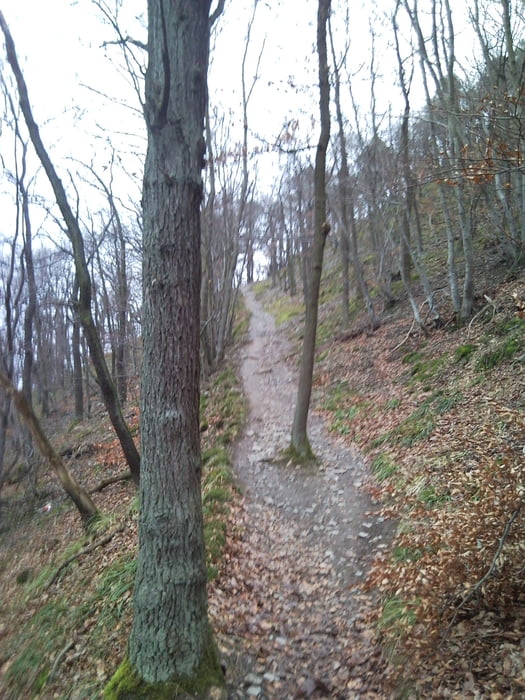
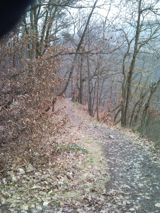
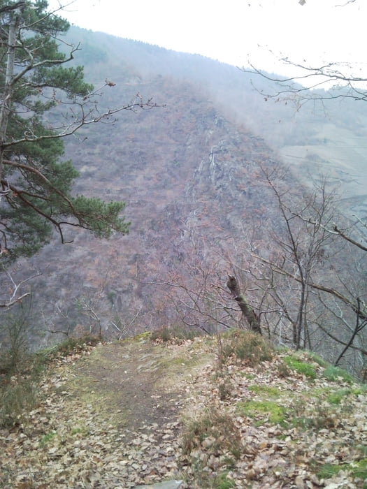
Schoner Trail vom Schrock über Teufelsley wieder ins Ahrtal.

Startpunkt ist am Bahnhof in Mayschoß auf dem großen Parkplatz. Von da gehts erstmal saftig bergauf bis zum Schrock. Ab hier beginnt dann der Trailspaß bis ins Tal. Einer der Top Spots an der Ahr. Allerdings teilweise auch mit leicht kniffligen Stellen, somit villeicht für Neulinge mit Vorsicht anzugehen. Wer fahren kann braucht nirgendwo absteigen und hat unten angekommen garantiert ein Grinsen im Gesicht.


Galerie du tour

Carte du tour et altitude

  • Open Street Map
  • Google
Minimum height 120 m Maximum height 406 m Vue de détail

More about the tour author

tommy80
Member since 2008

Send private message

Commentaires

Benny1980 on 29.08.2011

Schön

Also der Aufstieg ist echt nicht schlecht. Aber es hat sich gelohnt. Klasse Tour. Mach ich bestimmt bald wieder.
Mayschoß liegt inmitten des Ahrtals, der Bahnhof ist leicht zu finden.

Tracks GPS

Trackpoints
  • GPX / Garmin Map Source (gpx) download
  • TCX / Garmin Training Center® (tcx) download
  • CRS / Garmin Training Center® (crs) download
  • Google Earth (kml) download
  • G7ToWin (g7t) download
  • TTQV (trk) download
  • Overlay (ovl) download
  • Fugawi (txt) download
  • Kompass (DAV) Track (tk) download
  • Feuille de tours (pdf) download
  • Original file of the author (gpx) download

More about the tour author

tommy80
Member since 2008

Send private message
Share track
Add to my favorites
Remove from my favorites
Edit tags
My score
Rate
Tour: Mayschoß Fun Trail
Cat.: Mountainbike
Longueur: 9,3 km
Evaluated on:
Durée:
Day(s)
Hour(s)
Minute(s)
Evaluation: Paysage Aspect amusement Condition Technique