Login

Login oublié ?

Cookies have to be accepted!
Your browser's cookie functionality is disabled. Please enable this functionality.

Not a member yet?

Register now
Login

Available for registred users only

Log in to use this feature.

Login oublié ?

Cookies have to be accepted!
Your browser's cookie functionality is disabled. Please enable this functionality.

Not a member yet?

Register now
Filter
Catégories
Advanced filters
  • Longueur (km)
  • Altimètre
Enregistrer le filtre Reset filter

TrackRank

QRCode

Technical data

Longueur39,6 km Altimètre799 m Way down803 m Durée03:30 h:m Date24.04.2011
Evaluations Author Paysage Aspect amusement Condition Technique

Statistiques

491 Vues Evaluations 51 Téléchargements Moyenne
Rate
  • Feuille de tours
  • Arrivée
  • Téléchargements
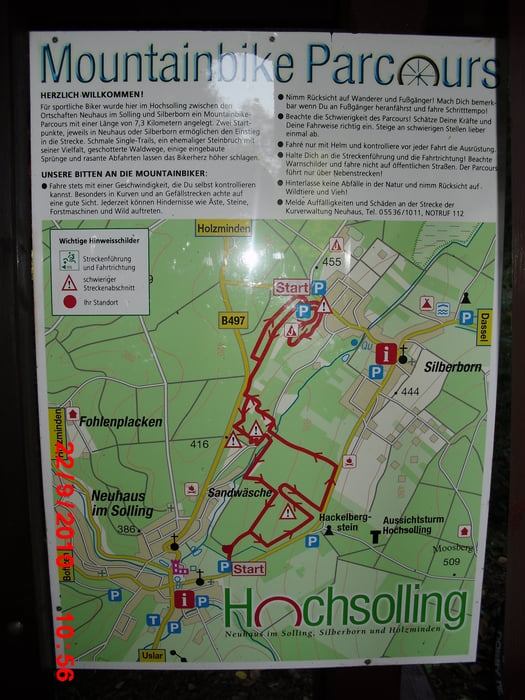
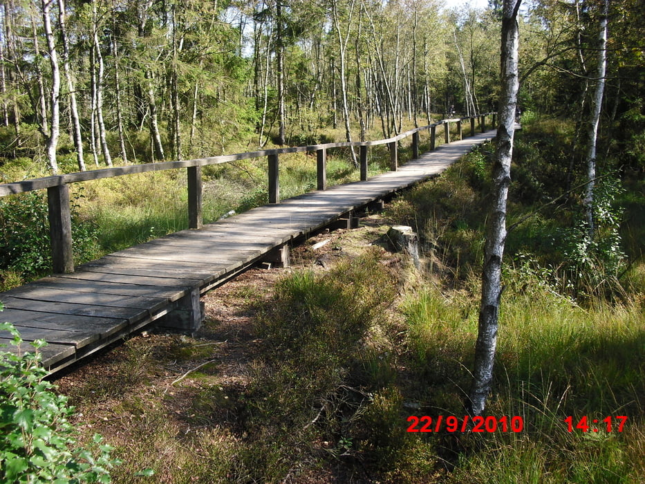
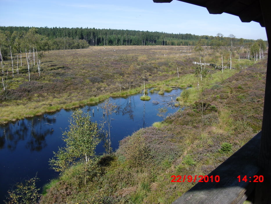
Tour durch  den Hochsolling. Start ist am MTB Parcours in Silberborn, am Ende geht es über die Holzstege und das Moor wieder zurück zum Ausgangspunkt.

Galerie du tour

Carte du tour et altitude

  • Open Street Map
  • Google
Minimum height 163 m Maximum height 494 m Vue de détail

More about the tour author

spockibaba
Member since 2010

Send private message

Commentaires

Parkplatz oberhalb von Silberborn. Start des MTB Parcours und auch Parkplatz für den Hochseilgarten (TreeRock).

Tracks GPS

Trackpoints
  • GPX / Garmin Map Source (gpx) download
  • TCX / Garmin Training Center® (tcx) download
  • CRS / Garmin Training Center® (crs) download
  • Google Earth (kml) download
  • G7ToWin (g7t) download
  • TTQV (trk) download
  • Overlay (ovl) download
  • Fugawi (txt) download
  • Kompass (DAV) Track (tk) download
  • Feuille de tours (pdf) download
  • Original file of the author (gpx) download

More about the tour author

spockibaba
Member since 2010

Send private message
Share track
Add to my favorites
Remove from my favorites
Edit tags
My score
Rate
Tour: Durch den Solling
Cat.: Mountainbike
Longueur: 39,6 km
Evaluated on:
Durée:
Day(s)
Hour(s)
Minute(s)
Evaluation: Paysage Aspect amusement Condition Technique