


Vom Schwimmbad über die Alte Straße nach napplach, dann die alte Teuchelstraße hinauf in die Teuchl. ( dieser Teil ist Schotterstraße) über die neue Teuchl Straße geht es dann wieder zurück nach napplach. Als Abschluss wird noch der Danielsberg umfahren.
Ich finde das ist eine der schönsten Touren im unteren Mölltal
Ich finde das ist eine der schönsten Touren im unteren Mölltal
Further information at
http://www.gaestehaus-graf.atGalerie du tour
Carte du tour et altitude
Minimum height 633 m
Maximum height 1305 m
More about the tour author

|
mastergraf |
Commentaires
Ausgangspunkt ist das Gästehaus Graf
www.gaestehaus-graf.at
Auto:
von Salzburg: Tauernautobahn A10, Abfahrt Lendorf, weiter Richtung Mölltal (Mallnitz) über Möllbrücke, Mühldorf bis Reißeck
von Süden: Grenzübergang Tarvisio, Autobahn Villach, Spittal, Abfahrt Mallnitz, weiter bis Reißeck
Bahn: Mit Bahn nach Spittal Millstätter See und von dort mittels Regionalzug oder Bus nach Kolbnitz
Tracks GPS
Trackpoints-
GPX / Garmin Map Source (gpx) download
-
TCX / Garmin Training Center® (tcx) download
-
CRS / Garmin Training Center® (crs) download
-
Google Earth (kml) download
-
G7ToWin (g7t) download
-
TTQV (trk) download
-
Overlay (ovl) download
-
Fugawi (txt) download
-
Kompass (DAV) Track (tk) download
-
Feuille de tours (pdf) download
More about the tour author
|
|
mastergraf |
Add to my favorites
Remove from my favorites
Edit tags
Open track
My score
Rate
Tour de Teuchl
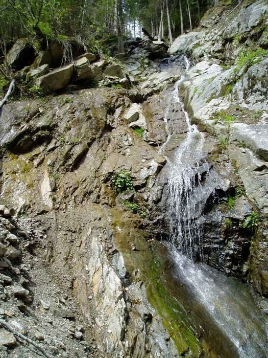
Die Fahrt entlang der alten Straße (Bild) ist Natur pur.
Mountainbike