


Kombitour aus San Giovanni & Monte Casale (für gut trainierte Biker)
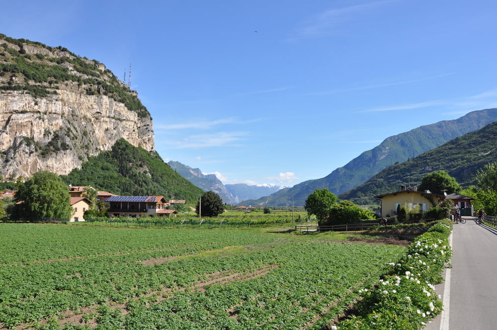
Die Tour beginnt beim Villa Stella (Torbole), verläuft am Sarca Radweg (alternativer Einstieg bei Mecki) bis Arco. Ab Varigano bis Padaro "sehr sportlicher" Anstieg (frühe Abfahrt in den Sommermonaten empfehlenswert, wegen der Hitze). Alles komplett Aphaltstraße.
2. Hälfte bis San Giovanni dann gleichmäßig gut zu fahren (auch flache Passagen). In San Giovanni - Einkehrmöglichkeit.
--- optional kann bis hier gut geshuttelt werden ---
Anschließend geht es weiter Richtung "Monte Casale" - die erste Hälfte relativ gleichmäßig auf gut zu fahrenden Waldwegen bis zur Malga Val Bona. Ab der Malga val Bona wird es dann wieder gut sportlich mit intensiven Anstiegen und einer Schiebepassage im Wald (nur kurz ca. 2-300 m).
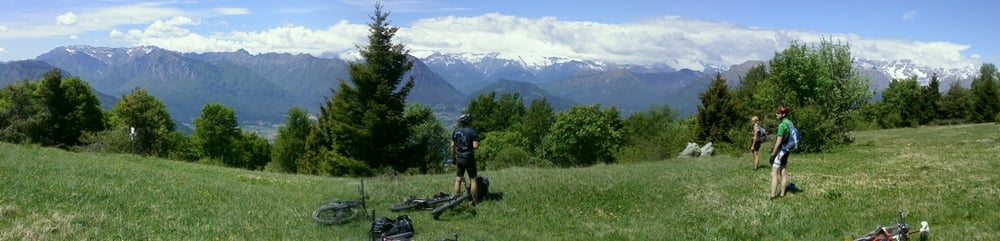
Nach der Schiebepassage wirst Du mit einem schön und idyllisch gelegenen Hochplatteu belohnt - tolle Ausblicke bis in Brenta und ab hier folgt ein schöner "flowiger Trail" mit ein paar Wurzelpassagen - aber nicht schwierig. Weiterhin wirst Du mit reizenden Blicken über das Sarchatal belohnt. Dann folgt eine schöne und gut fahrbare Schotterpiste bis oberhalb von Lundo. In Lundo geht es dann wieder auf einem "sehr sehr sportlichen Uphill" zum San Giovanni. Hierbei sind 3 Abschnitte sehr steil, hier ist vorhandene Kondition und Kraftausdauer notwendig.
Ab San Giovanni der "Klassiker als Downhill unterhalb des Boca di Tovo"!
Optionaler Downhill bis Tenno (an Mäuerchen links) nur für gute Downhiller empfehlenswert - Ansonsten der Mosertourbeschreibung bis nach Tenno folgen!!!
Galerie du tour
Carte du tour et altitude
Minimum height 16 m
Maximum height 1493 m
More about the tour author
|
|
t-runner |
Commentaires

Tracks GPS
Trackpoints-
GPX / Garmin Map Source (gpx) download
-
TCX / Garmin Training Center® (tcx) download
-
CRS / Garmin Training Center® (crs) download
-
Google Earth (kml) download
-
G7ToWin (g7t) download
-
TTQV (trk) download
-
Overlay (ovl) download
-
Fugawi (txt) download
-
Kompass (DAV) Track (tk) download
-
Feuille de tours (pdf) download
-
Original file of the author (gpx) download
More about the tour author
|
|
t-runner |
Add to my favorites
Remove from my favorites
Edit tags
Open track
My score
Rate