Login

Login oublié ?

Cookies have to be accepted!
Your browser's cookie functionality is disabled. Please enable this functionality.

Not a member yet?

Register now
Login

Available for registred users only

Log in to use this feature.

Login oublié ?

Cookies have to be accepted!
Your browser's cookie functionality is disabled. Please enable this functionality.

Not a member yet?

Register now
Filter
Catégories
Advanced filters
  • Longueur (km)
  • Altimètre
Enregistrer le filtre Reset filter

TrackRank

QRCode

Technical data

Longueur12,6 km Altimètre272 m Way down12 m Durée00:46 h:m Date30.05.2011
Evaluations Author Paysage Aspect amusement Condition Technique

Statistiques

552 Vues Evaluations 13 Téléchargements Moyenne
Rate
  • Feuille de tours
  • Arrivée
  • Téléchargements


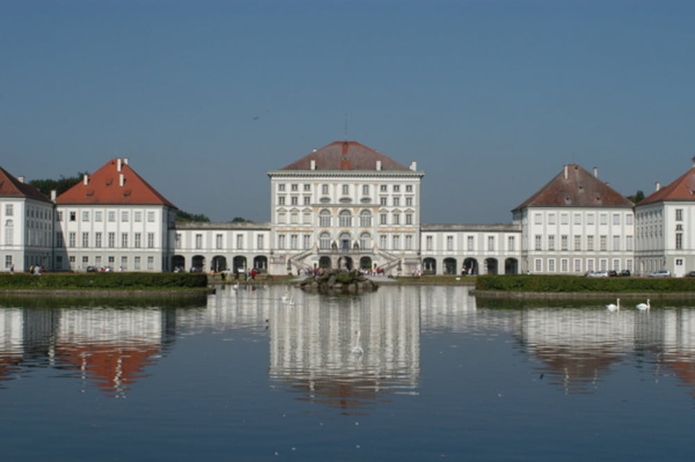
Die Tour verläuft auf Radwegen entlang von realtiv viel befahrenen Strassen. Fürs Training gut, landschaftlich bis auf den Blick auf's Schloss Nymphenburg nicht so interessant.


Carte du tour et altitude

  • Open Street Map
  • Google
Minimum height 290 m Maximum height 553 m Vue de détail

More about the tour author

klausera
Member since 2011

Send private message

Commentaires

Tracks GPS

Trackpoints
  • GPX / Garmin Map Source (gpx) download
  • TCX / Garmin Training Center® (tcx) download
  • CRS / Garmin Training Center® (crs) download
  • Google Earth (kml) download
  • G7ToWin (g7t) download
  • TTQV (trk) download
  • Overlay (ovl) download
  • Fugawi (txt) download
  • Kompass (DAV) Track (tk) download
  • Feuille de tours (pdf) download
  • Original file of the author (gpx) download

More about the tour author

klausera
Member since 2011

Send private message
Share track
Add to my favorites
Remove from my favorites
Edit tags
My score
Rate
Tour: Pasing Nymphenburg
Cat.: Patins à roues alignées
Longueur: 12,6 km
Evaluated on:
Durée:
Day(s)
Hour(s)
Minute(s)
Evaluation: Paysage Aspect amusement Condition Technique