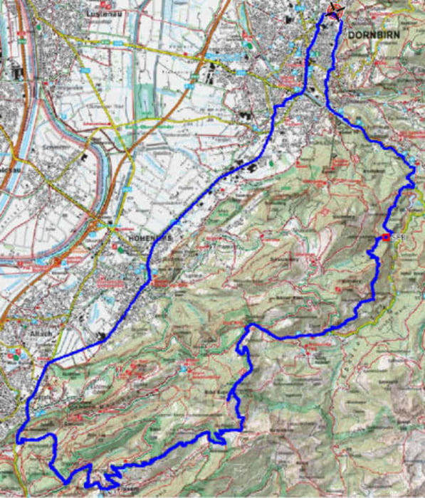
Anfahrt ueber Goetzis, Arbogast, Oerflaschlucht, Fraxern, Orsanka, Hohe Kugel. Runter den Fussweg zum Fluhereck. Als Belohnung gibt es ab Ebnit die Traumabfahrt durch den Hackwald. Achtung, Abfahrt ist nur fuer Geuebte und bei gutem Wetter zu empfehlen.
ca. 1495 Hoehenmeter.
ca. 1495 Hoehenmeter.
Further information at
http://klauserg.dyndns.org/1701_08_1_index_sport_bike_tour8.phpGalerie du tour
Carte du tour et altitude
Minimum height 406 m
Maximum height 1650 m
Commentaires
Traumtour mit Blick auf das Rheintal und anspruchsvoller Abfahrt
Tracks GPS
Trackpoints-
GPX / Garmin Map Source (gpx) download
-
TCX / Garmin Training Center® (tcx) download
-
CRS / Garmin Training Center® (crs) download
-
Google Earth (kml) download
-
G7ToWin (g7t) download
-
TTQV (trk) download
-
Overlay (ovl) download
-
Fugawi (txt) download
-
Kompass (DAV) Track (tk) download
-
Feuille de tours (pdf) download
-
Original file of the author (gpx) download
Add to my favorites
Remove from my favorites
Edit tags
Open track
My score
Rate


Tourbewertung