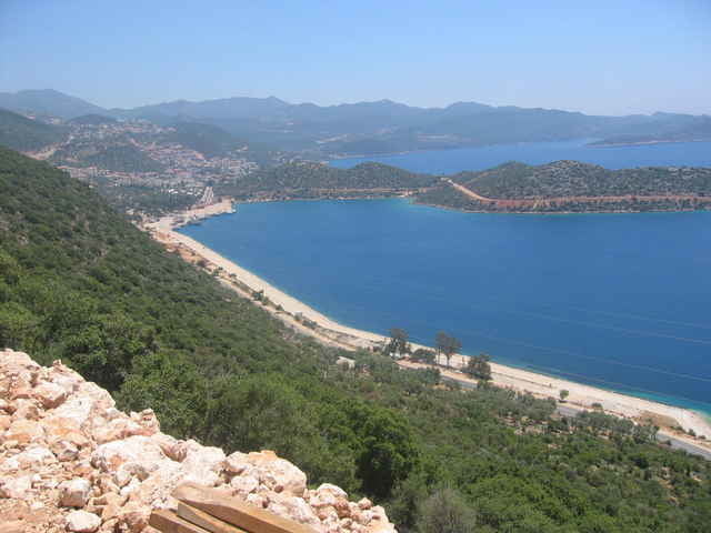
Traumhafte Aussicht auf Kas mit seiner Halbinsel und die Umgebung. Größtenteils Asphalt, letztes Stück steile Schotterstraße abwärts.
Für diese Region gibt auch es ein Buch von Werner Eichhorn (www.bike-guide-tuerkei.eu): Bike Guide Türkische Riviera, 2007 Bergverlag Rother, ISBN 978-3-7633-5017-9
Für diese Region gibt auch es ein Buch von Werner Eichhorn (www.bike-guide-tuerkei.eu): Bike Guide Türkische Riviera, 2007 Bergverlag Rother, ISBN 978-3-7633-5017-9
Galerie du tour
Carte du tour et altitude
Minimum height -17 m
Maximum height 538 m
Commentaires
Tracks GPS
Trackpoints-
GPX / Garmin Map Source (gpx) download
-
TCX / Garmin Training Center® (tcx) download
-
CRS / Garmin Training Center® (crs) download
-
Google Earth (kml) download
-
G7ToWin (g7t) download
-
TTQV (trk) download
-
Overlay (ovl) download
-
Fugawi (txt) download
-
Kompass (DAV) Track (tk) download
-
Feuille de tours (pdf) download
-
Original file of the author (gpx) download
Add to my favorites
Remove from my favorites
Edit tags
Open track
My score
Rate


Schöne Tour
Schade ist eben der hohe Asphaltanteil.
Tour 20
(Die in ost/west Richtung verlaufende Rampe mit den zwei Serpentinen wurde leider unlängst asphaltiert)
CU
WE