Login

Login oublié ?

Cookies have to be accepted!
Your browser's cookie functionality is disabled. Please enable this functionality.

Not a member yet?

Register now
Login

Available for registred users only

Log in to use this feature.

Login oublié ?

Cookies have to be accepted!
Your browser's cookie functionality is disabled. Please enable this functionality.

Not a member yet?

Register now
Filter
Catégories
Advanced filters
  • Longueur (km)
  • Altimètre
Enregistrer le filtre Reset filter

TrackRank

QRCode

Technical data

Longueur90,1 km Altimètre0 m Way down0 m Durée07:00 h:m Date21.09.2011
Evaluations Author User Paysage Aspect amusement Condition Technique

Statistiques

550 Vues Evaluations 50 Téléchargements Moyenne
Rate
  • Feuille de tours
  • Arrivée
  • Téléchargements
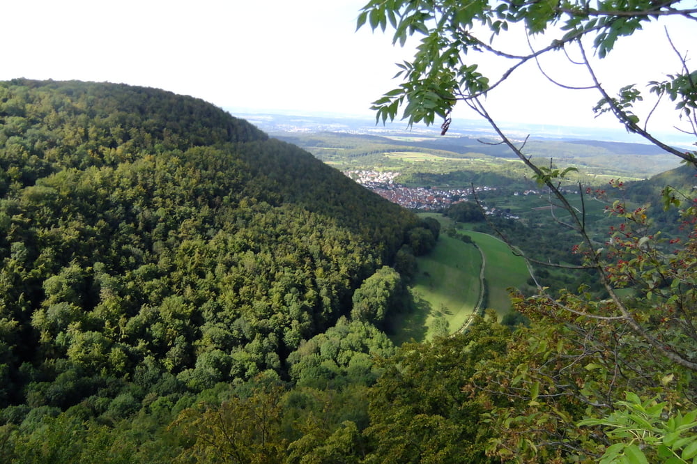
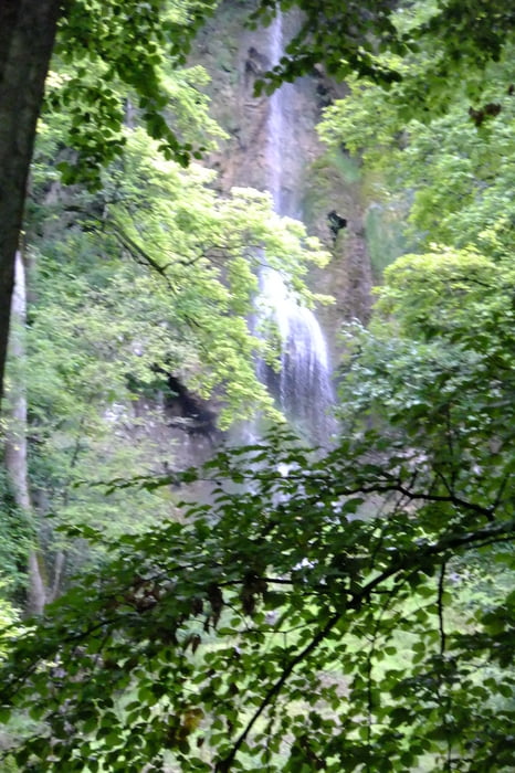
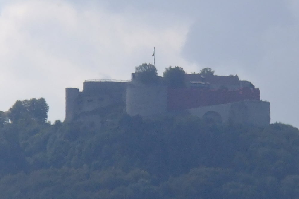
Tour von Wendlingen über Beuren zum Hohenneuffen hoch und dann übers Kaltental an Hülben vorbei runter nach Bad Urach zum Wasserfall. Zum Schluß gemütlich über Dettingen Erms Neuhausen Metzingen übern Florian nach Grafenberg. Von Grafenberg über Tischard und Frickenhausen nach Nürtingen und dann nach Wendlingen!

Galerie du tour

Carte du tour et altitude

  • Open Street Map
  • Google
Minimum height 99999 m Maximum height -99999 m Vue de détail

More about the tour author

a211lex
Member since 2011

Send private message

Commentaires

Starten kann man überall sei es ab dem Golfplatz in Wendlingen oder in der Kirchheimer Innenstadt in Beuren, Metzingen oder in Urach je nachdem wo man her kommt.

Tracks GPS

Trackpoints
  • GPX / Garmin Map Source (gpx) download
  • TCX / Garmin Training Center® (tcx) download
  • CRS / Garmin Training Center® (crs) download
  • Google Earth (kml) download
  • G7ToWin (g7t) download
  • TTQV (trk) download
  • Overlay (ovl) download
  • Fugawi (txt) download
  • Kompass (DAV) Track (tk) download
  • Feuille de tours (pdf) download
  • Original file of the author (gpx) download

More about the tour author

a211lex
Member since 2011

Send private message
Share track
Add to my favorites
Remove from my favorites
Edit tags
My score
Rate
Tour: Wendlingen-Hohenneuffen-Bad Urach Wasserfall-Wendlingen
Cat.: Mountainbike
Longueur: 90,1 km
Evaluated on:
Durée:
Day(s)
Hour(s)
Minute(s)
Evaluation: Paysage Aspect amusement Condition Technique