Login

Login oublié ?

Cookies have to be accepted!
Your browser's cookie functionality is disabled. Please enable this functionality.

Not a member yet?

Register now
Login

Available for registred users only

Log in to use this feature.

Login oublié ?

Cookies have to be accepted!
Your browser's cookie functionality is disabled. Please enable this functionality.

Not a member yet?

Register now
Filter
Catégories
Advanced filters
  • Longueur (km)
  • Altimètre
Enregistrer le filtre Reset filter

TrackRank

QRCode

Technical data

Longueur8,2 km Altimètre348 m Way down349 m Durée02:30 h:m Date29.09.2011
Evaluations Author Paysage Aspect amusement Condition Technique

Statistiques

136 Vues Evaluations 9 Téléchargements Moyenne
Rate
  • Feuille de tours
  • Arrivée
  • Téléchargements
Diese Wanderung verläuft auf Forst- und Feldwegen. Von Rocca Susella zurück zum Ausgangspunkt folgt man der Asphaltstraße bis San Paolo, dann weiter auf Feldwegen bis zur SP 184.

Galerie du tour

Carte du tour et altitude

  • Open Street Map
  • Google
Minimum height 215 m Maximum height 555 m Vue de détail

More about the tour author

rödivomsee
Member since 2008

Send private message

Commentaires

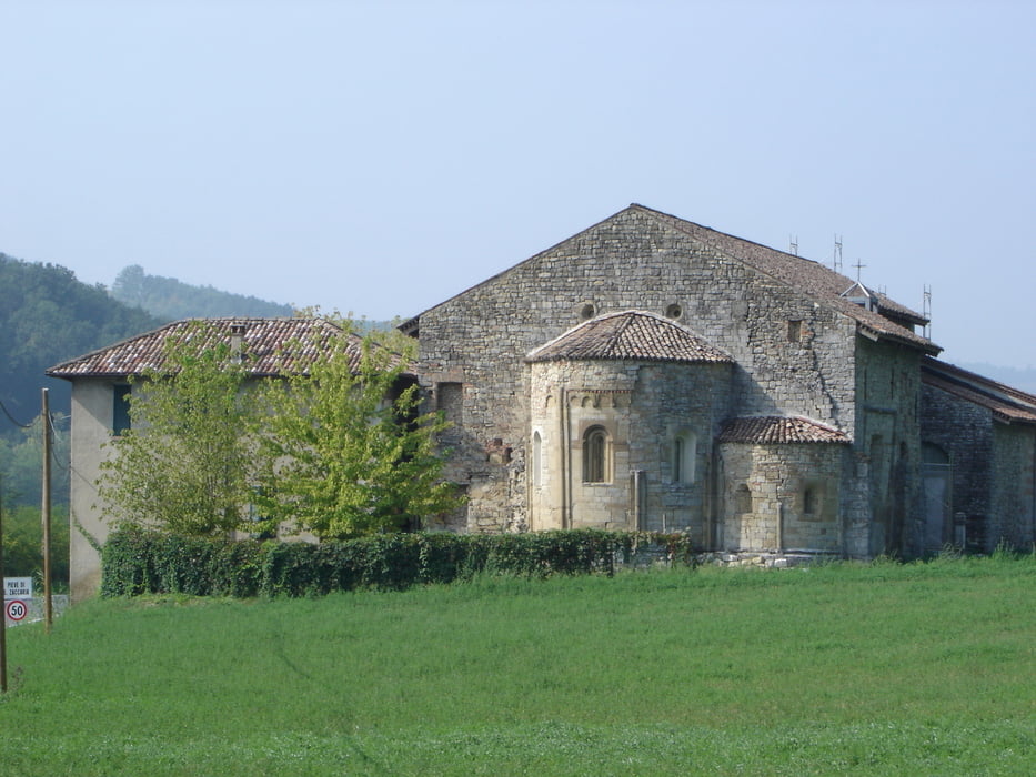
Von Voghera nimmt man die SS 461 bis Godiasco. Am Ende der Ortschaft geht es dann links auf die SP 184 in Richtung Rocca Susella. Nach etwa 4 km kommt auf der linken Straßenseite die sehenswerte Kirche San Zaccaria wo es einen Parkplatz gibt.


Tracks GPS

Trackpoints
  • GPX / Garmin Map Source (gpx) download
  • TCX / Garmin Training Center® (tcx) download
  • CRS / Garmin Training Center® (crs) download
  • Google Earth (kml) download
  • G7ToWin (g7t) download
  • TTQV (trk) download
  • Overlay (ovl) download
  • Fugawi (txt) download
  • Kompass (DAV) Track (tk) download
  • Feuille de tours (pdf) download
  • Original file of the author (gpx) download

More about the tour author

rödivomsee
Member since 2008

Send private message
Share track
Add to my favorites
Remove from my favorites
Edit tags
My score
Rate
Tour: San Zaccaria
Cat.: Randonnées
Longueur: 8,2 km
Evaluated on:
Durée:
Day(s)
Hour(s)
Minute(s)
Evaluation: Paysage Aspect amusement Condition Technique