


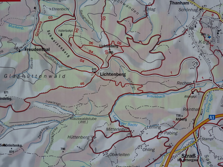
Zuerst ungefähr 2,5 km auf einer Forststraße ziemlich flach bis zu einer Wegkreuzung - nun über einen steilen Steig in Richtung Lichtenberg - am Waldrand angekommen, rechts den Weg entlang zu den Häusern von Lichtenberg - zwischen den Häusern und beim Berggasthof Danter vorbei - kurz auf einer Asfaltstraße entlang - an der Kreuzung gerade weiter bis zur Kurve - hier hat man schon eine herrliche Aussicht - weiter links über einen Steig zum Gipfel - dort steht ein gewaltiger, neu errichteter Aussichtsturm, von dem sich eine grandiose Fernsicht bietet. Einkehrmöglichkeit beim Berggasthof Danter.
Abstieg auf der Asphaltstraße nach Thalham.
Galerie du tour


Carte du tour et altitude
Minimum height 557 m
Maximum height 883 m
More about the tour author

|
Commentaires

ÖBB bis Vöcklamarkt - dann weiter mit Regionalbahn bis St. Georgen/Attergau - weiter zum Startpunkt in Thalham entweder zu Fuss oder mit dem Mountainbike.
Tracks GPS
Trackpoints-
GPX / Garmin Map Source (gpx) download
-
TCX / Garmin Training Center® (tcx) download
-
CRS / Garmin Training Center® (crs) download
-
Google Earth (kml) download
-
G7ToWin (g7t) download
-
TTQV (trk) download
-
Overlay (ovl) download
-
Fugawi (txt) download
-
Kompass (DAV) Track (tk) download
-
Feuille de tours (pdf) download
-
Original file of the author (gpx) download
More about the tour author
|
|
Add to my favorites
Remove from my favorites
Edit tags
Open track
My score
Rate