Login

Login oublié ?

Cookies have to be accepted!
Your browser's cookie functionality is disabled. Please enable this functionality.

Not a member yet?

Register now
Login

Available for registred users only

Log in to use this feature.

Login oublié ?

Cookies have to be accepted!
Your browser's cookie functionality is disabled. Please enable this functionality.

Not a member yet?

Register now
Filter
Catégories
Advanced filters
  • Longueur (km)
  • Altimètre
Enregistrer le filtre Reset filter

TrackRank

QRCode

Technical data

Longueur14,4 km Altimètre840 m Way down944 m Durée02:36 h:m Date26.11.2011
Evaluations Author Paysage Aspect amusement Condition Technique

Statistiques

356 Vues Evaluations 15 Téléchargements Moyenne
Rate
  • Feuille de tours
  • Arrivée
  • Téléchargements

26.11.2011

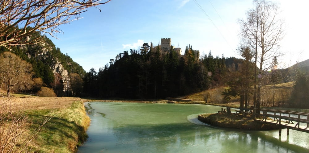
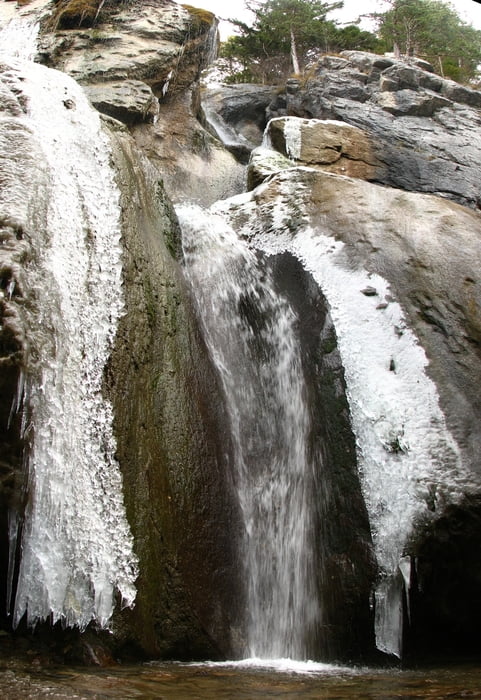
Mali sme ísť na Schneeberg, no nehorázne silný vietor, najmä v nárazoch, nás odradil (keby som bol sám, idem ďalej, no pokiaľ, to netuším...). Tak sme si dali niečo na okolí, pozreli sme si vodopád. Taký dôchodcovský výletík. :-D

Galerie du tour

Carte du tour et altitude

  • Open Street Map
  • Google
Minimum height 668 m Maximum height 1444 m Vue de détail

More about the tour author

tmax
Member since 2007

Send private message

Commentaires

Losenheim

Tracks GPS

Trackpoints
  • GPX / Garmin Map Source (gpx) download
  • TCX / Garmin Training Center® (tcx) download
  • CRS / Garmin Training Center® (crs) download
  • Google Earth (kml) download
  • G7ToWin (g7t) download
  • TTQV (trk) download
  • Overlay (ovl) download
  • Fugawi (txt) download
  • Kompass (DAV) Track (tk) download
  • Feuille de tours (pdf) download
  • Original file of the author (gpx) download

More about the tour author

tmax
Member since 2007

Send private message
Share track
Add to my favorites
Remove from my favorites
Edit tags
My score
Rate
Tour: 20111126_Pokus o Schneeberg, Sebastian Wasserfall
Cat.: Randonnées
Longueur: 14,4 km
Evaluated on:
Durée:
Day(s)
Hour(s)
Minute(s)
Evaluation: Paysage Aspect amusement Condition Technique