Login

Login oublié ?

Cookies have to be accepted!
Your browser's cookie functionality is disabled. Please enable this functionality.

Not a member yet?

Register now
Login

Available for registred users only

Log in to use this feature.

Login oublié ?

Cookies have to be accepted!
Your browser's cookie functionality is disabled. Please enable this functionality.

Not a member yet?

Register now
Filter
Catégories
Advanced filters
  • Longueur (km)
  • Altimètre
Enregistrer le filtre Reset filter

TrackRank

QRCode

Technical data

Longueur11,9 km Altimètre196 m Way down206 m Durée03:00 h:m Date29.01.2012
Evaluations Author Paysage Aspect amusement Condition Technique

Statistiques

593 Vues Evaluations 62 Téléchargements Moyenne
Rate
  • Feuille de tours
  • Arrivée
  • Téléchargements

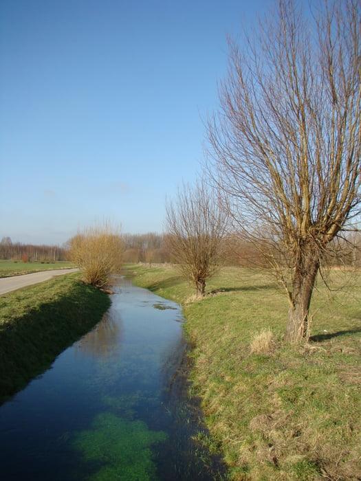
Door het hoogwater was de oorspronkelijk uitgewerkte route niet uitvoerbaar.

Dit alternatief mag er ook wezen.

Galerie du tour

Carte du tour et altitude

  • Open Street Map
  • Google
Minimum height 53 m Maximum height 101 m Vue de détail

More about the tour author

ikkel
Member since 2009

Send private message

Commentaires

Stevig schoeisel is aan te raden.i

Tracks GPS

Trackpoints
  • GPX / Garmin Map Source (gpx) download
  • TCX / Garmin Training Center® (tcx) download
  • CRS / Garmin Training Center® (crs) download
  • Google Earth (kml) download
  • G7ToWin (g7t) download
  • TTQV (trk) download
  • Overlay (ovl) download
  • Fugawi (txt) download
  • Kompass (DAV) Track (tk) download
  • Feuille de tours (pdf) download
  • Original file of the author (gpx) download

More about the tour author

ikkel
Member since 2009

Send private message
Share track
Add to my favorites
Remove from my favorites
Edit tags
My score
Rate
Tour: Wandelen in Julich
Cat.: Randonnées
Longueur: 11,9 km
Evaluated on:
Durée:
Day(s)
Hour(s)
Minute(s)
Evaluation: Paysage Aspect amusement Condition Technique