Login

Login oublié ?

Cookies have to be accepted!
Your browser's cookie functionality is disabled. Please enable this functionality.

Not a member yet?

Register now
Login

Available for registred users only

Log in to use this feature.

Login oublié ?

Cookies have to be accepted!
Your browser's cookie functionality is disabled. Please enable this functionality.

Not a member yet?

Register now
Filter
Catégories
Advanced filters
  • Longueur (km)
  • Altimètre
Enregistrer le filtre Reset filter

TrackRank

QRCode

Technical data

Longueur13,4 km Altimètre164 m Way down169 m Durée01:10 h:m Date12.02.2012
Evaluations Author Paysage Aspect amusement Condition Technique

Statistiques

315 Vues Evaluations 10 Téléchargements Moyenne
Rate
  • Feuille de tours
  • Arrivée
  • Téléchargements
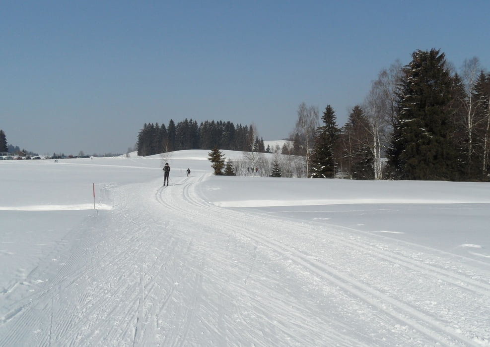
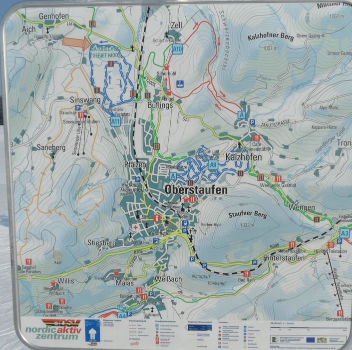
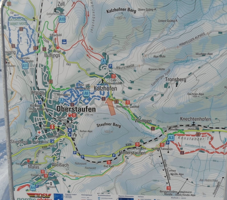
 Loipe (klassisch und skating) von Oberstaufen zur Hündleloipe/Alpsee und zurück.

 Parken und Einkehr siehe Wegpunkte

Further information at

http://oberstaufen.de/natur/winter/langlaufen/

Galerie du tour

Carte du tour et altitude

  • Open Street Map
  • Google
Minimum height 749 m Maximum height 815 m Vue de détail

More about the tour author

skyhopper
Member since 2005

Send private message

Commentaires

Parken siehe Wegpunkte 

Tracks GPS

Trackpoints
  • GPX / Garmin Map Source (gpx) download
  • TCX / Garmin Training Center® (tcx) download
  • CRS / Garmin Training Center® (crs) download
  • Google Earth (kml) download
  • G7ToWin (g7t) download
  • TTQV (trk) download
  • Overlay (ovl) download
  • Fugawi (txt) download
  • Kompass (DAV) Track (tk) download
  • Feuille de tours (pdf) download
  • Original file of the author (gpx) download

More about the tour author

skyhopper
Member since 2005

Send private message
Share track
Add to my favorites
Remove from my favorites
Edit tags
My score
Rate
Tour: Westallgäu: von Oberstaufen zur Hündleloipe
Cat.: Ski de fond
Longueur: 13,4 km
Evaluated on:
Durée:
Day(s)
Hour(s)
Minute(s)
Evaluation: Paysage Aspect amusement Condition Technique