


Vorbemerkung: Diese Genusstour ist technisch wirklich nicht anspruchsvoll und kann evtl. auch mit einem Tourenrad befahren werden.
Von der Fähre Bad Breisig/Rheinbrohl geht es zunächst Richtung Arienheller und dann am Bahlsbach entlang auf schottrigem Waldweg hinauf zum Limesweg (Untrainierte werden evtl. ein kurzes Steilstück schieben).
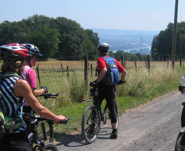
Oben angekommen bewegt man sich im Wesentlichen in relativ flachem Gelände (Waldwege, teilweise asphaltierte Straße). Ein Abstecher zum Aussichtsturm (siehe GPS-Daten) lohnt auf jeden Fall. Der Weg auf den Turm wird mit einer tollen Panoramasicht belohnt.
Weiter geht es wieder auf Waldwegen bis hin zum Lokal Brombeerschenke (ab 14:30 Uhr geöffnet; Mo., Di Ruhetag; empfiehlt sich nicht nur wegen der Aussicht für eine Pause) und weiter Richtung Leutesdorf (asphaltierte Straße). Nach kurzer Zeit kommt man dicht an der Edmundhütte vorbei (So. bewirtschaftet). Ein Besuch lohnt schon allein wegen der tolen Aussicht über das Rheintal).
Dann weiter auf asphaltierter Straße hinunter nach Leutesdorf (mehrere Weinlokale locken) und auf dem Radweg zurück zur Fähre.
Von der Fähre Bad Breisig/Rheinbrohl geht es zunächst Richtung Arienheller und dann am Bahlsbach entlang auf schottrigem Waldweg hinauf zum Limesweg (Untrainierte werden evtl. ein kurzes Steilstück schieben).
Oben angekommen bewegt man sich im Wesentlichen in relativ flachem Gelände (Waldwege, teilweise asphaltierte Straße). Ein Abstecher zum Aussichtsturm (siehe GPS-Daten) lohnt auf jeden Fall. Der Weg auf den Turm wird mit einer tollen Panoramasicht belohnt.
Weiter geht es wieder auf Waldwegen bis hin zum Lokal Brombeerschenke (ab 14:30 Uhr geöffnet; Mo., Di Ruhetag; empfiehlt sich nicht nur wegen der Aussicht für eine Pause) und weiter Richtung Leutesdorf (asphaltierte Straße). Nach kurzer Zeit kommt man dicht an der Edmundhütte vorbei (So. bewirtschaftet). Ein Besuch lohnt schon allein wegen der tolen Aussicht über das Rheintal).
Dann weiter auf asphaltierter Straße hinunter nach Leutesdorf (mehrere Weinlokale locken) und auf dem Radweg zurück zur Fähre.
Further information at
http://www.brombeerschenke.de/Galerie du tour
Carte du tour et altitude
Minimum height 61 m
Maximum height 367 m
More about the tour author

|
LöhndorfBiker |
Commentaires

Linksrheinisch bis Bahnhof Bad Breisig /rechtsrheinisch bis Bahnhof Bad Hönningen und weiter zur Fähre. In der Nähe gibt es einige Parkmöglichkeiten.
Tracks GPS
Trackpoints-
GPX / Garmin Map Source (gpx) download
-
TCX / Garmin Training Center® (tcx) download
-
CRS / Garmin Training Center® (crs) download
-
Google Earth (kml) download
-
G7ToWin (g7t) download
-
TTQV (trk) download
-
Overlay (ovl) download
-
Fugawi (txt) download
-
Kompass (DAV) Track (tk) download
-
Feuille de tours (pdf) download
-
Original file of the author (gpx) download
More about the tour author
|
|
LöhndorfBiker |
Add to my favorites
Remove from my favorites
Edit tags
Open track
My score
Rate