


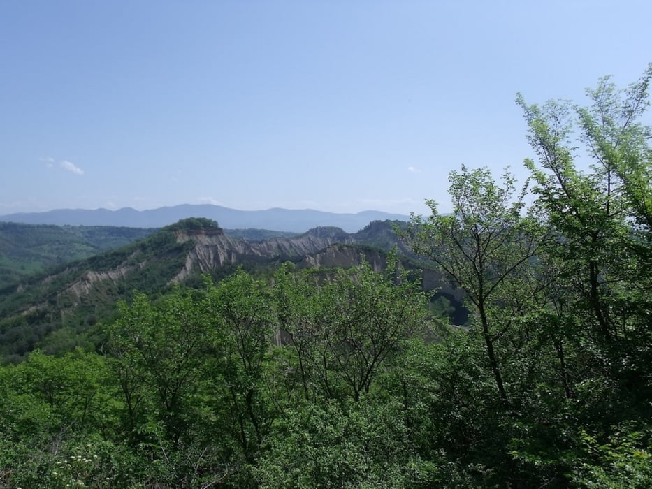
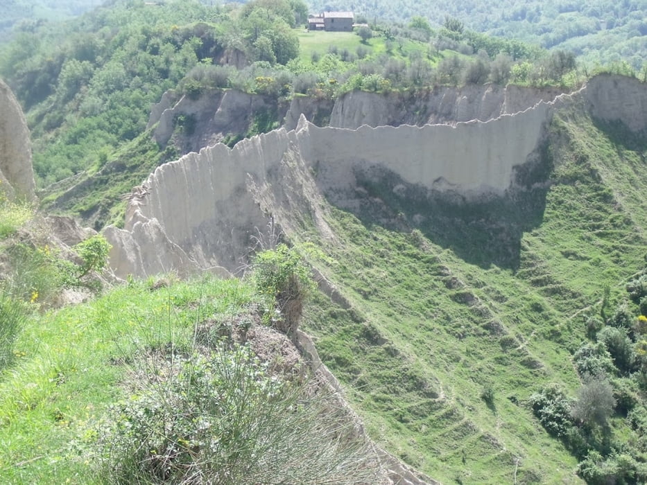
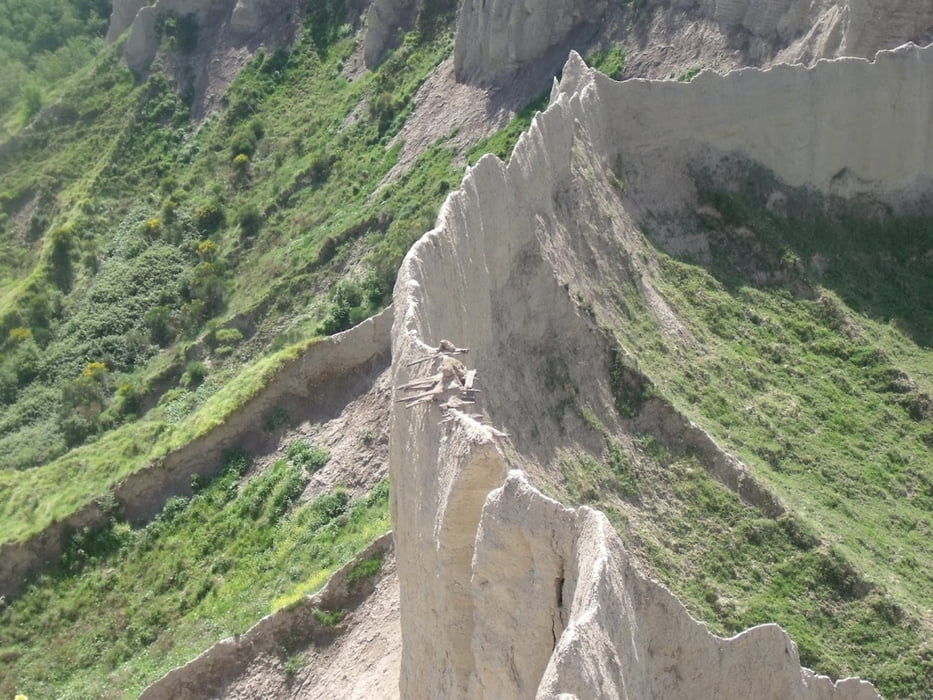
Splendida passeggiata che parte da Lubriano paese ai confini tra Umbria e Lazio, che passa per Civita di Bagnoregio per poi proseguire verso i Calanchi di Bagnoregio fino al Pianale dove si gode di un fantastico panorama
Further information at
http://maps.google.it/maps?q=Lubriano&hl=it&geocode=+&hnear=Lubriano+Viterbo,+Lazio&t=w&z=13Galerie du tour
Carte du tour et altitude
Minimum height 223 m
Maximum height 452 m
More about the tour author
|
|
Barone67 |
Commentaires
Per chi viene da Roma
Prendete l'autostrada A1; uscite ad Orvieto; seguite le indicazioni per Castiglione in Teverina/Bagnoregio, al bivio di Castiglione, Lubriano/Bagnoregio proseguite in direzione Lubriano/Bagnoregio, dopo circa 8 Km si arriva a Lubriano.
Per chi viene da Viterbo
Prendete la S.P. Teverina fino Celleno, poi proseguite in direzione Bagnoregio/Lubriano. Una volta a Bagnoregio proseguite per Lubriano, dopo 3 km si arriva in paese.
Per chi viene da Firenze
Prendete l'autostrada A1; uscite ad Orvieto; seguite le indicazioni per Castiglione in Teverina/Bagnoregio, al bivio Castiglione, Lubriano/Bagnoregio proseguite in direzione Lubriano/Bagnoregio, dopo circa 8 Km si arriva a Lubriano.
Tracks GPS
Trackpoints-
GPX / Garmin Map Source (gpx) download
-
TCX / Garmin Training Center® (tcx) download
-
CRS / Garmin Training Center® (crs) download
-
Google Earth (kml) download
-
G7ToWin (g7t) download
-
TTQV (trk) download
-
Overlay (ovl) download
-
Fugawi (txt) download
-
Kompass (DAV) Track (tk) download
-
Feuille de tours (pdf) download
-
Original file of the author (gpx) download
More about the tour author
|
|
Barone67 |
Add to my favorites
Remove from my favorites
Edit tags
Open track
My score
Rate
Tote Kuh