Login

Zapomniałeś swój login?

Cookies have to be accepted!
Your browser's cookie functionality is disabled. Please enable this functionality.

Not a member yet?

Register now
Login

Available for registred users only

Log in to use this feature.

Zapomniałeś swój login?

Cookies have to be accepted!
Your browser's cookie functionality is disabled. Please enable this functionality.

Not a member yet?

Register now
Filter
Kategorie
Advanced filters
  • Długość (km)
  • Wysokość
Zapisz filtr Reset filter

TrackRank

QRCode

Technical data

Długość98,2 km Wysokość1804 m Way down1862 m Czas trwania00:00 h:m Data21.05.2012
Oceny Author Krajobraz Czynnik zadowolenia Kondycja Technika

Statystyka

664 Widoki Oceny 121 Downloads / Pliki do pobrania Przeciętnie
Rate
  • Karta trasy
  • Dojazd
  • Downloads / Pliki do pobrania
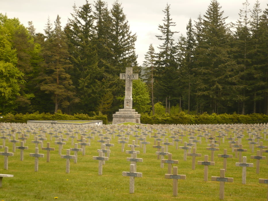
Anspruchsvolle Runde z.T auf der Route des Crete aber auch über Pässe wie Col du Wettstein, wo ein Soldatenfriedhof vom 1. Weltkrieg zu sehen ist...

Mapa trasy i profil wysokości

  • Open Street Map
  • Google
Minimum height 199 m Maximum height 1219 m Widok szczegółowy

More about the tour author

thomi64
Member since 2011

Send private message

Komentarze

Ausgangsort z.B. Munster oder Kaiserberg, aber auch der Col du Bonhome.

GPS tracks

Trackpoints
  • GPX / Garmin Map Source (gpx) download
  • TCX / Garmin Training Center® (tcx) download
  • CRS / Garmin Training Center® (crs) download
  • Google Earth (kml) download
  • G7ToWin (g7t) download
  • TTQV (trk) download
  • Overlay (ovl) download
  • Fugawi (txt) download
  • Kompass (DAV) Track (tk) download
  • Karta trasy (pdf) download
  • Original file of the author (gpx) download

More about the tour author

thomi64
Member since 2011

Send private message
Share track
Add to my favorites
Remove from my favorites
Edit tags
My score
Rate
Trasa: Route des Crêtes
Rodzaj: Rower szosowy
Długość: 98,2 km
Evaluated on:
Czas trwania:
Day(s)
Hour(s)
Minute(s)
Ocena: Krajobraz Czynnik zadowolenia Kondycja Technika