Login

Zapomniałeś swój login?

Cookies have to be accepted!
Your browser's cookie functionality is disabled. Please enable this functionality.

Not a member yet?

Register now
Login

Available for registred users only

Log in to use this feature.

Zapomniałeś swój login?

Cookies have to be accepted!
Your browser's cookie functionality is disabled. Please enable this functionality.

Not a member yet?

Register now
Filter
Kategorie
Advanced filters
  • Długość (km)
  • Wysokość
Zapisz filtr Reset filter

TrackRank

QRCode

Technical data

Długość7,2 km Wysokość258 m Way down275 m Czas trwania02:30 h:m Data23.05.2012
Oceny Author Krajobraz Czynnik zadowolenia Kondycja Technika

Statystyka

601 Widoki Oceny 70 Downloads / Pliki do pobrania Przeciętnie
Rate
  • Karta trasy
  • Dojazd
  • Downloads / Pliki do pobrania

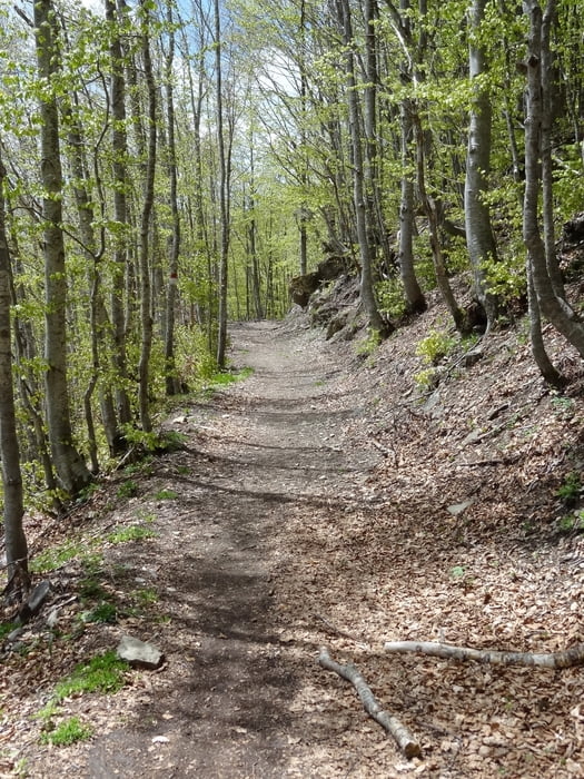
Die Wanderung verläuft auf Pfaden, Waldwegen und Forststraßen. Vom Passo delle Radici bis zum nächsten Abzweig muss man ca. 1km auf einer Asphaltstraße wandern.

Die Wegbeschreibung kann im Wanderführer Rother Toskana Nord nachgelesen werden.
 

Further information at

http://www.rother.de/titpage/4115.php

Galeria trasy

Mapa trasy i profil wysokości

  • Open Street Map
  • Google
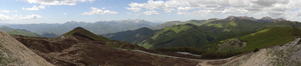
Minimum height 1455 m Maximum height 1700 m Widok szczegółowy

More about the tour author

rödivomsee
Member since 2008

Send private message

Komentarze

Ausgangspunkt der Wanderung ist in San Pellegrino. Hier gibt es direkt am Anfang von der Wanderung einen Parkplatz.
 

GPS tracks

Trackpoints
  • GPX / Garmin Map Source (gpx) download
  • TCX / Garmin Training Center® (tcx) download
  • CRS / Garmin Training Center® (crs) download
  • Google Earth (kml) download
  • G7ToWin (g7t) download
  • TTQV (trk) download
  • Overlay (ovl) download
  • Fugawi (txt) download
  • Kompass (DAV) Track (tk) download
  • Karta trasy (pdf) download
  • Original file of the author (gpx) download

More about the tour author

rödivomsee
Member since 2008

Send private message
Share track
Add to my favorites
Remove from my favorites
Edit tags
My score
Rate
Trasa: Alpe di San Pellegrino
Rodzaj: Wędrówki
Długość: 7,2 km
Evaluated on:
Czas trwania:
Day(s)
Hour(s)
Minute(s)
Ocena: Krajobraz Czynnik zadowolenia Kondycja Technika