Login

Zapomniałeś swój login?

Cookies have to be accepted!
Your browser's cookie functionality is disabled. Please enable this functionality.

Not a member yet?

Register now
Login

Available for registred users only

Log in to use this feature.

Zapomniałeś swój login?

Cookies have to be accepted!
Your browser's cookie functionality is disabled. Please enable this functionality.

Not a member yet?

Register now
Filter
Kategorie
Advanced filters
  • Długość (km)
  • Wysokość
Zapisz filtr Reset filter

TrackRank

QRCode

Technical data

Długość62,8 km Wysokość1996 m Way down1983 m Czas trwania04:29 h:m Data03.06.2012
Oceny Author Krajobraz Czynnik zadowolenia Kondycja Technika

Statystyka

951 Widoki Oceny 214 Downloads / Pliki do pobrania Przeciętnie
Rate
  • Karta trasy
  • Dojazd
  • Downloads / Pliki do pobrania
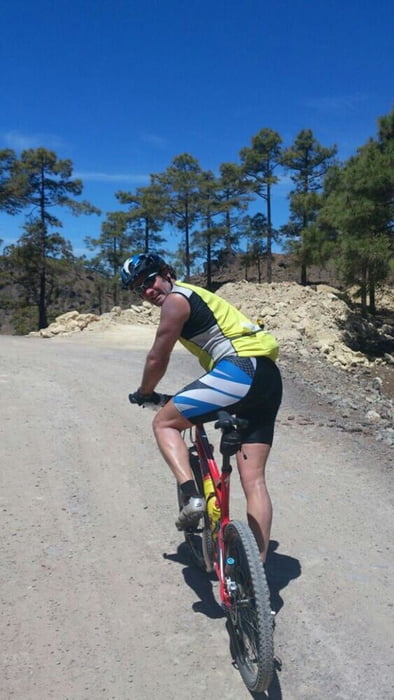
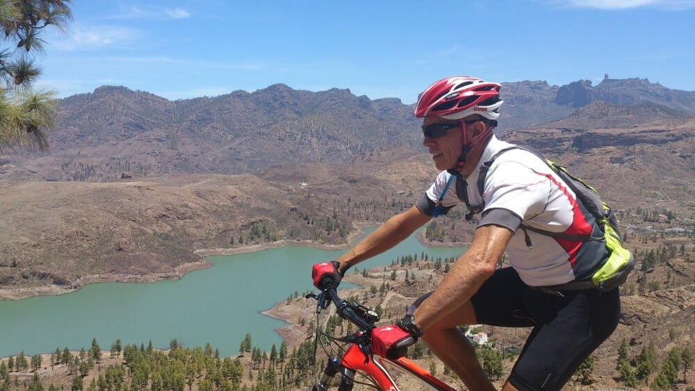
Ruta de mtb se inicia por carretera,para llegar no demasiado agotados a la parte de sendero y pistas ya que son algo exigentes.Paisajes y vistas bonitas de la zona de Chira.Trialeras tecnicas y bastantes ciclables.

Galeria trasy

Mapa trasy i profil wysokości

  • Open Street Map
  • Google
Minimum height 31 m Maximum height 1300 m Widok szczegółowy

More about the tour author

madeheimclaudio
Member since 2010

Send private message

Komentarze

Salida del parking del parque del sur.Subida por asfalto hasta Tunte y luego Hacia la cruz de la Plata.Alli iniciamos por pista forestal y senderos.

GPS tracks

Trackpoints
  • GPX / Garmin Map Source (gpx) download
  • TCX / Garmin Training Center® (tcx) download
  • CRS / Garmin Training Center® (crs) download
  • Google Earth (kml) download
  • G7ToWin (g7t) download
  • TTQV (trk) download
  • Overlay (ovl) download
  • Fugawi (txt) download
  • Kompass (DAV) Track (tk) download
  • Karta trasy (pdf) download
  • Original file of the author (tcx) download

More about the tour author

madeheimclaudio
Member since 2010

Send private message
Share track
Add to my favorites
Remove from my favorites
Edit tags
My score
Rate
Trasa: MTB Maspalomas Claudio
Rodzaj: Rower górski (MTB)
Długość: 62,8 km
Evaluated on:
Czas trwania:
Day(s)
Hour(s)
Minute(s)
Ocena: Krajobraz Czynnik zadowolenia Kondycja Technika