


Start und Ende ist der Gomadinger Bahnhof auf der Schwäbischen Alb nahe Münsingen. Es geht von hier ca. 30 km sanft bergab durchs schöne und sehr beliebte Lautertal. An Wochenenden ist deshalb mit sehr vielen Radlern zu rechnen.
Ab Lauterach geht es links weg zum Schloss Mochental weiter nach Kirchen und steil hoch auf Albniveau. Diese 200 Höhenmeter werden danach in eine rasante Abfahrt investiert und man ist dann im nächsten Flusstal. Diesen Schmiechental- radweg verlässt man in Sondernach um der Bahnstrecke bis Münsingen zu folgen. Vor Münsingen geht es über die Fauserhöhe nach Marbach zum Ausgangspunkt Gomadingen.
Alle Wege sind gut geschottert bzw. asphaltiert; keine Autostraßen.
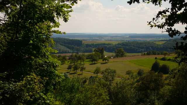
Galeria trasy
Mapa trasy i profil wysokości
Minimum height 518 m
Maximum height 745 m
More about the tour author

|
raapl |
Komentarze

L248 oder L230
Parken kann man am Bahnhof Gomadingen
Parken kann man am Bahnhof Gomadingen
GPS tracks
Trackpoints-
GPX / Garmin Map Source (gpx) download
-
TCX / Garmin Training Center® (tcx) download
-
CRS / Garmin Training Center® (crs) download
-
Google Earth (kml) download
-
G7ToWin (g7t) download
-
TTQV (trk) download
-
Overlay (ovl) download
-
Fugawi (txt) download
-
Kompass (DAV) Track (tk) download
-
Karta trasy (pdf) download
-
Original file of the author (gpx) download
More about the tour author
|
|
raapl |
Add to my favorites
Remove from my favorites
Edit tags
Open track
My score
Rate