
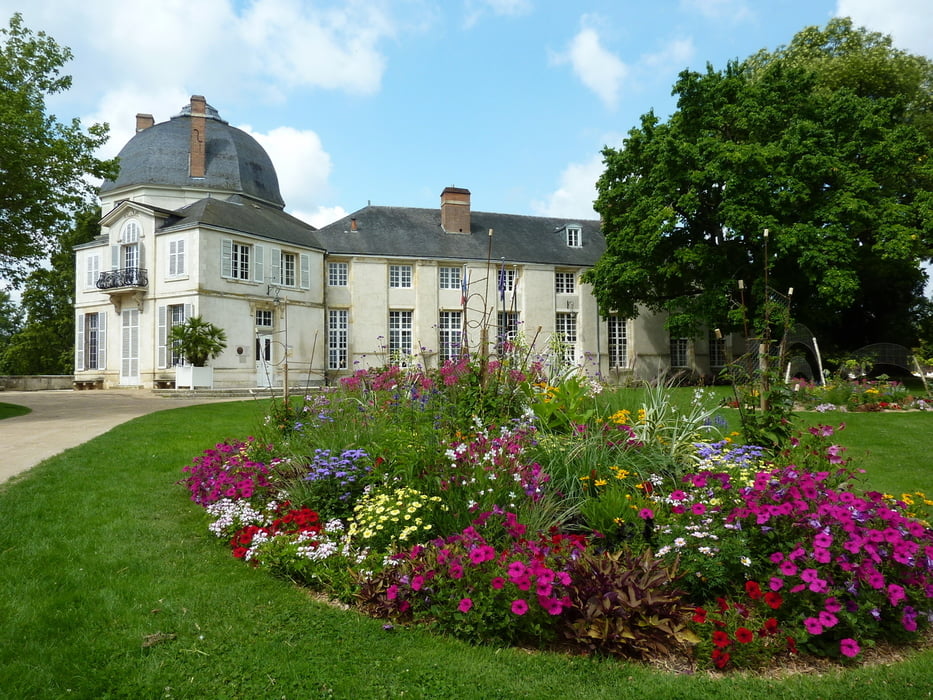

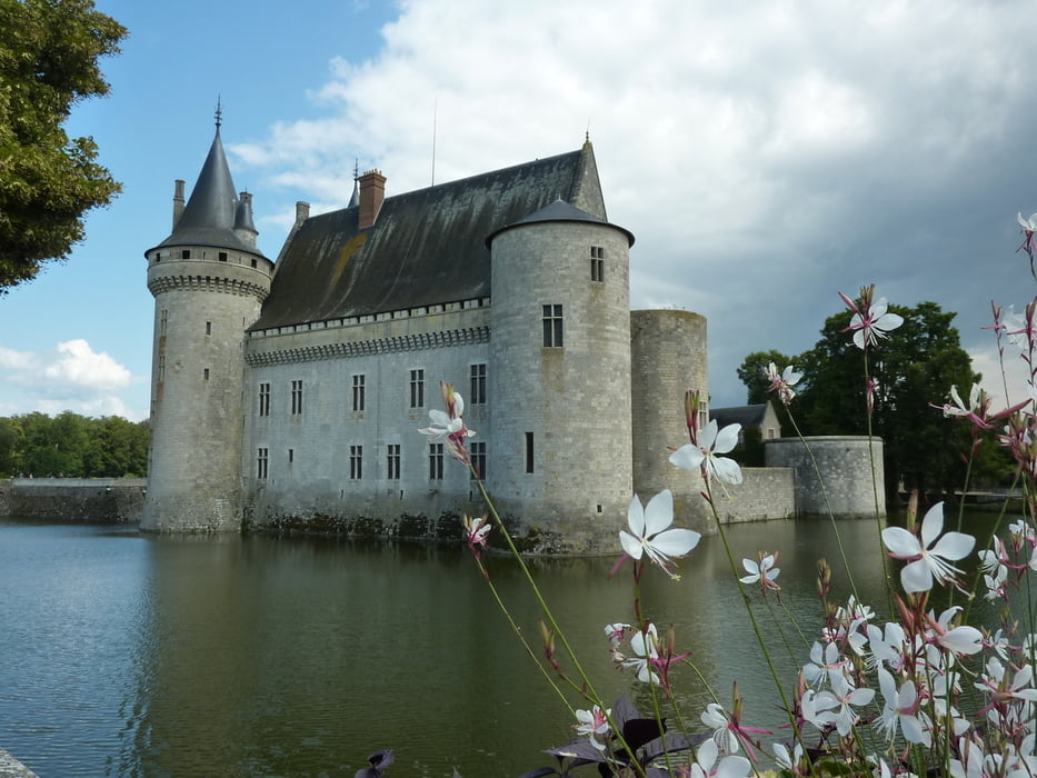
Wir starten von einem Parkplatz in St. Denis de I´Hótel und fahren flußaufwärts entlang der Loire. Erstes Zwischenziel ist Cháteauneuf-Sur-Loire einem beschaulichen Städtchen mit einem schönen Park und kleinem Schloß. Für eine Pause genau das Richtige . Frisch gestärkt geht es weiter bis nach Sully-Sur-Loire, dem Ziel dieser Tour, wo das Schloss den Eingang der Stadt markiert. Das Sehenswerte Schloss ist von einem Park umgeben und im Städtchen kann man bei einer Tasse Café entspannen, bevor es auf den Rückweg geht.
Wir fahren noch in St. Benolt-Sur-Loire vorbei, wo die Abby sehr sehenswert ist, gegen abend kommen wir dann wieder in unserem Ausgangspunkt an.
Galeria trasy


Mapa trasy i profil wysokości
Minimum height 95 m
Maximum height 121 m
More about the tour author

|
extrembiker73 |
Komentarze

GPS tracks
Trackpoints-
GPX / Garmin Map Source (gpx) download
-
TCX / Garmin Training Center® (tcx) download
-
CRS / Garmin Training Center® (crs) download
-
Google Earth (kml) download
-
G7ToWin (g7t) download
-
TTQV (trk) download
-
Overlay (ovl) download
-
Fugawi (txt) download
-
Kompass (DAV) Track (tk) download
-
Karta trasy (pdf) download
-
Original file of the author (gpx) download
More about the tour author
|
|
extrembiker73 |
Add to my favorites
Remove from my favorites
Edit tags
Open track
My score
Rate