Login

Zapomniałeś swój login?

Cookies have to be accepted!
Your browser's cookie functionality is disabled. Please enable this functionality.

Not a member yet?

Register now
Login

Available for registred users only

Log in to use this feature.

Zapomniałeś swój login?

Cookies have to be accepted!
Your browser's cookie functionality is disabled. Please enable this functionality.

Not a member yet?

Register now
Filter
Kategorie
Advanced filters
  • Długość (km)
  • Wysokość
Zapisz filtr Reset filter

TrackRank

QRCode

Technical data

Długość44,1 km Wysokość673 m Way down664 m Czas trwania02:30 h:m Data23.07.2012
Oceny Author User Krajobraz Czynnik zadowolenia Kondycja Technika

Statystyka

473 Widoki Oceny 53 Downloads / Pliki do pobrania Przeciętnie
Rate
  • Karta trasy
  • Dojazd
  • Downloads / Pliki do pobrania


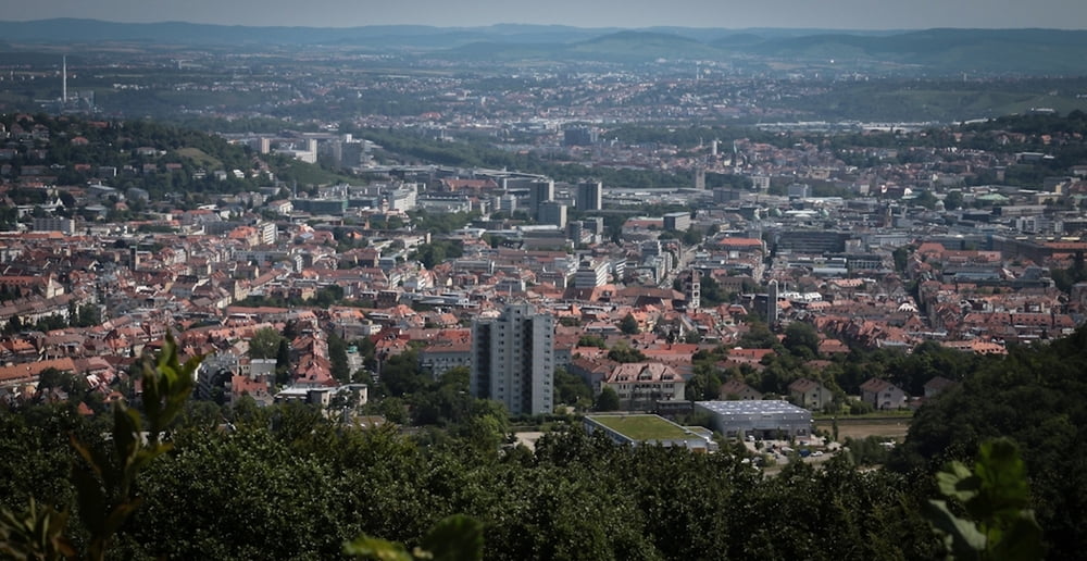
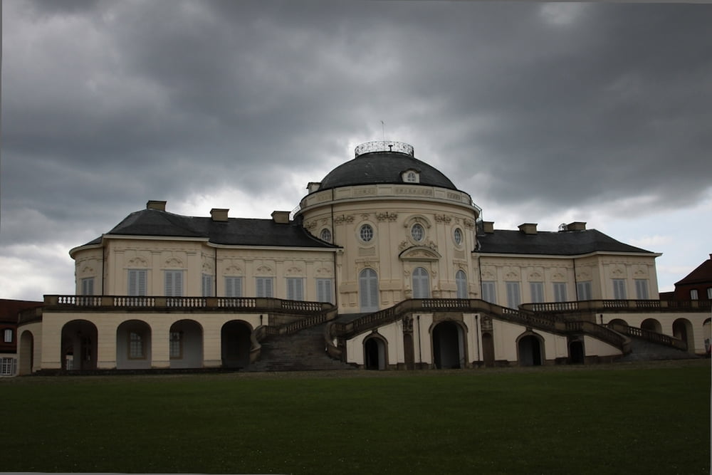
Von Schwieberdingen geht es zunächst hoch auf das Schloss Solitude! Dort angekommen geht es weiter zum Bärensee, Pfaffensee hinüber und hoch zum Birkenkopf in Suttgart Botnang.


Dort hat man dan einen herrlichen Weitblick über den Suttgarter Kessel bis an die Schwäbische Alb

Heimwärts gehts zuerst leider durch Wohnsiedlungen und Fußgängerzonen, aber man könnte bestimmt irgendwo ein kühles Getränk zu sich nehmen. Zwischendrin gibt es einen "Trail" entlang eines Baches

Viel Spaß


Galeria trasy

Mapa trasy i profil wysokości

  • Open Street Map
  • Google
Minimum height 255 m Maximum height 511 m Widok szczegółowy

More about the tour author

arnoldfischer
Member since 2012

Send private message

Komentarze

GPS tracks

Trackpoints
  • GPX / Garmin Map Source (gpx) download
  • TCX / Garmin Training Center® (tcx) download
  • CRS / Garmin Training Center® (crs) download
  • Google Earth (kml) download
  • G7ToWin (g7t) download
  • TTQV (trk) download
  • Overlay (ovl) download
  • Fugawi (txt) download
  • Kompass (DAV) Track (tk) download
  • Karta trasy (pdf) download
  • Original file of the author (gpx) download

More about the tour author

arnoldfischer
Member since 2012

Send private message
Share track
Add to my favorites
Remove from my favorites
Edit tags
My score
Rate
Trasa: Schwieberdingen-Bärensee-Birkenkopf
Rodzaj: Rower górski (MTB)
Długość: 44,1 km
Evaluated on:
Czas trwania:
Day(s)
Hour(s)
Minute(s)
Ocena: Krajobraz Czynnik zadowolenia Kondycja Technika