

Schöne MTB-Tour von Bolsterlang ins Bolgental und dann auf's Riedberger Horn - Anfangs steile Auffahrt bis zur Alpe Zunkleiten. Überwiegend auf Asphalt zieht es permanent nach oben, bis es dann nach links zu einem Abstecher auf's Riedberger Horn geht.
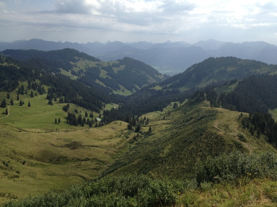
Zum Horn kurze Schiebe- bzw. Tragepassage. Oben eine super Aussicht ins Kleinwalsertal und die Oberstdorfer Berge sowie nach Balderschwang! Die Abfahrt ist ein Genuss!
Vorbei am Berghaus Schwaben Richtung Bergstation der Hörnerbahn.
Steil bergab (Achtung teilweise feiner Kies auf dem Weg) zur Talstation. Von dort über Bolsterlang wieder zum Startpunkt.
Einkehrmöglichkeiten: Alpe Zunkleiten, Alpe Bolgen, Berghaus Schwaben, Bergstation Hörnerbahn
Galeria trasy


Mapa trasy i profil wysokości
Minimum height 870 m
Maximum height 1783 m
More about the tour author
|
|
tkwaho |
Komentarze

B19 Kempten Richtung Oberstdorf - in Fischen rechts ab Richtung Obermaiselstein/Balderschwang - rechts nach Bolsterlang - Start am Parkplatz Skilift Sonderdorf (vor Bolsterlang links abbiegen)
GPS tracks
Trackpoints-
GPX / Garmin Map Source (gpx) download
-
TCX / Garmin Training Center® (tcx) download
-
CRS / Garmin Training Center® (crs) download
-
Google Earth (kml) download
-
G7ToWin (g7t) download
-
TTQV (trk) download
-
Overlay (ovl) download
-
Fugawi (txt) download
-
Kompass (DAV) Track (tk) download
-
Karta trasy (pdf) download
-
Original file of the author (gpx) download
More about the tour author
|
|
tkwaho |
Add to my favorites
Remove from my favorites
Edit tags
Open track
My score
Rate