Login

Zapomniałeś swój login?

Cookies have to be accepted!
Your browser's cookie functionality is disabled. Please enable this functionality.

Not a member yet?

Register now
Login

Available for registred users only

Log in to use this feature.

Zapomniałeś swój login?

Cookies have to be accepted!
Your browser's cookie functionality is disabled. Please enable this functionality.

Not a member yet?

Register now
Filter
Kategorie
Advanced filters
  • Długość (km)
  • Wysokość
Zapisz filtr Reset filter

TrackRank

QRCode

Technical data

Długość34,8 km Wysokość668 m Way down663 m Czas trwania03:00 h:m Data26.08.2012
Oceny Author User Krajobraz Czynnik zadowolenia Kondycja Technika

Statystyka

1034 Widoki 1 Ocena 117 Downloads / Pliki do pobrania 4.00 Przeciętnie
Rate
  • Karta trasy
  • Dojazd
  • Downloads / Pliki do pobrania
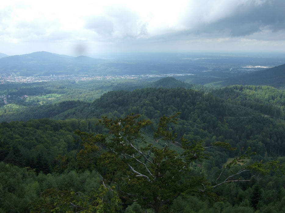
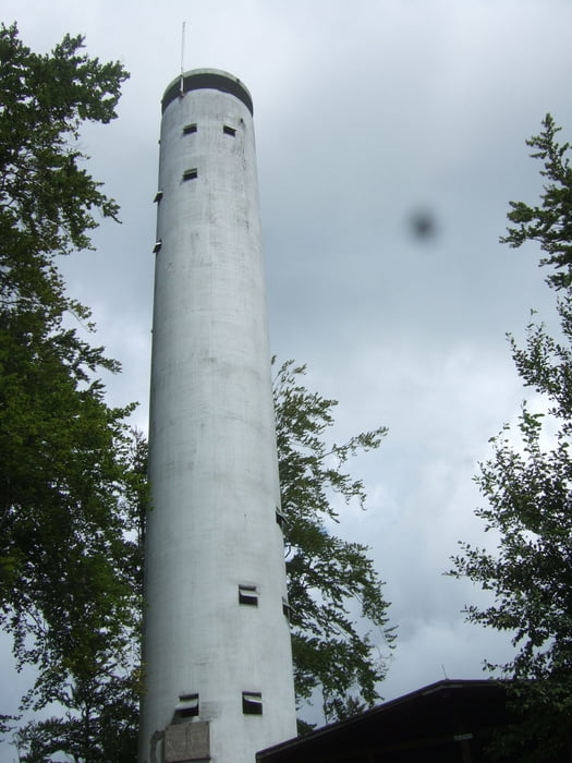
Vom Horbachpark in Ettlingen gehts den Berg hoch Richtung Rimmelsbacher Hof. An der Carl-Schurz Hütte Richtung Mahlberg-Turm. Von dort hat hat man eine schöne Aussicht. Die Abfahrt ins Rheintal über das Waldprechtstal und zurück nach Ettlingen über den Waldsaumpfad.

Galeria trasy

Mapa trasy i profil wysokości

  • Open Street Map
  • Google
Minimum height 132 m Maximum height 616 m Widok szczegółowy

More about the tour author

lemongras
Member since 2012

Send private message

Komentarze

eriei on 08.09.2013

Schöne Tour

Schöne Tour, die man auch problemlos am Nachmittag schafft. Bei entsprechendem Wetter ist dann auch die Sicht vom Turm wunderbar. Herzlichen Dank.

GPS tracks

Trackpoints
  • GPX / Garmin Map Source (gpx) download
  • TCX / Garmin Training Center® (tcx) download
  • CRS / Garmin Training Center® (crs) download
  • Google Earth (kml) download
  • G7ToWin (g7t) download
  • TTQV (trk) download
  • Overlay (ovl) download
  • Fugawi (txt) download
  • Kompass (DAV) Track (tk) download
  • Karta trasy (pdf) download
  • Original file of the author (gpx) download

More about the tour author

lemongras
Member since 2012

Send private message
Share track
Add to my favorites
Remove from my favorites
Edit tags
My score
Rate
Trasa: Von Ettlingen zum Mahlberg-Turm
Rodzaj: Rower górski (MTB)
Długość: 34,8 km
Evaluated on:
Czas trwania:
Day(s)
Hour(s)
Minute(s)
Ocena: Krajobraz Czynnik zadowolenia Kondycja Technika