Login

Zapomniałeś swój login?

Cookies have to be accepted!
Your browser's cookie functionality is disabled. Please enable this functionality.

Not a member yet?

Register now
Login

Available for registred users only

Log in to use this feature.

Zapomniałeś swój login?

Cookies have to be accepted!
Your browser's cookie functionality is disabled. Please enable this functionality.

Not a member yet?

Register now
Filter
Kategorie
Advanced filters
  • Długość (km)
  • Wysokość
Zapisz filtr Reset filter

TrackRank

QRCode

Technical data

Długość24,3 km Wysokość2405 m Way down2409 m Czas trwania00:00 h:m Data15.09.2012
Oceny Author Krajobraz Czynnik zadowolenia Kondycja Technika

Statystyka

813 Widoki Oceny 103 Downloads / Pliki do pobrania Przeciętnie
Rate
  • Karta trasy
  • Dojazd
  • Downloads / Pliki do pobrania

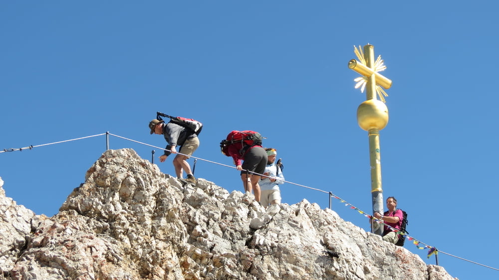
Der Höllental-Klettersteig ist unserer Meinung nach der schönste und abwechslungsreichste Weg auf Deutschlands höchsten Berg.

Gestartet sind wir zu der sehr langen Tour früh morgens gegen 6:00 Uhr am Campingplatz in Grainau. Zunächst geht es durch den Ort Richtung Hammersbach, wo der Wanderweg ins Höllental beginnt. Von hier aus haben wir nach ca. 1/2 Stunde den Eingang in die Höllentalklamm erreicht. Die Kasse war diesmal schon besetzt, so dass wir nicht wie vor neun Jahren kostenlos durch die Klamm durften.
 

Galeria trasy

Mapa trasy i profil wysokości

  • Open Street Map
  • Google
Minimum height 724 m Maximum height 2960 m Widok szczegółowy

More about the tour author

biauwe
Member since 2008

Send private message

Komentarze

GPS tracks

Trackpoints
  • GPX / Garmin Map Source (gpx) download
  • TCX / Garmin Training Center® (tcx) download
  • CRS / Garmin Training Center® (crs) download
  • Google Earth (kml) download
  • G7ToWin (g7t) download
  • TTQV (trk) download
  • Overlay (ovl) download
  • Fugawi (txt) download
  • Kompass (DAV) Track (tk) download
  • Karta trasy (pdf) download
  • Original file of the author (gpx) download

More about the tour author

biauwe
Member since 2008

Send private message
Share track
Add to my favorites
Remove from my favorites
Edit tags
My score
Rate
Trasa: Zur Zugspitze durch das Hölltal
Rodzaj: Wspinaczka ściankowa
Długość: 24,3 km
Evaluated on:
Czas trwania:
Day(s)
Hour(s)
Minute(s)
Ocena: Krajobraz Czynnik zadowolenia Kondycja Technika