Login

Zapomniałeś swój login?

Cookies have to be accepted!
Your browser's cookie functionality is disabled. Please enable this functionality.

Not a member yet?

Register now
Login

Available for registred users only

Log in to use this feature.

Zapomniałeś swój login?

Cookies have to be accepted!
Your browser's cookie functionality is disabled. Please enable this functionality.

Not a member yet?

Register now
Filter
Kategorie
Advanced filters
  • Długość (km)
  • Wysokość
Zapisz filtr Reset filter

TrackRank

QRCode

Technical data

Długość13,3 km Wysokość670 m Way down662 m Czas trwania04:00 h:m Data06.10.2012
Oceny Author Krajobraz Czynnik zadowolenia Kondycja Technika

Statystyka

807 Widoki Oceny 63 Downloads / Pliki do pobrania Przeciętnie
Rate
  • Karta trasy
  • Dojazd
  • Downloads / Pliki do pobrania

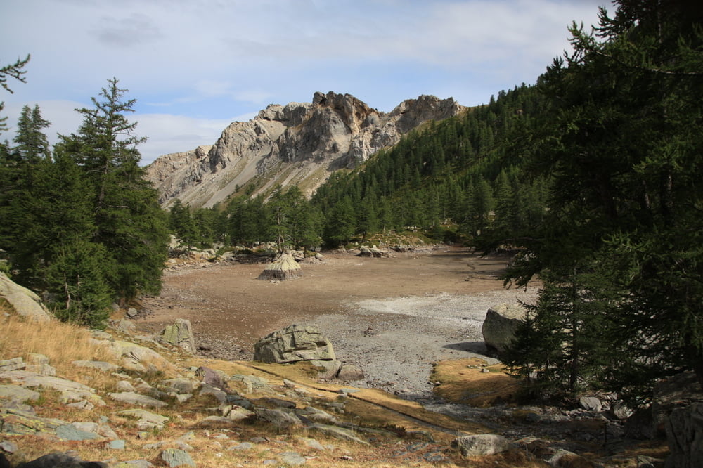
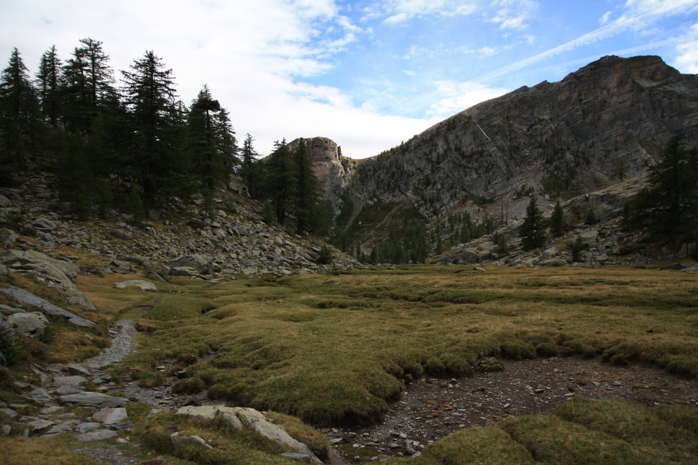
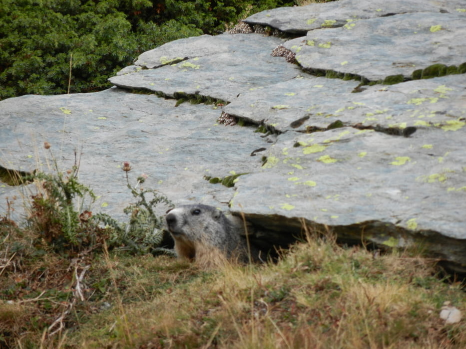
Der erste Weg bis zur Berghütte ist nicht wirklich spannend. Von dort aus allerdings beginnt eine traumhafte Tour zwischen Felsen und Seen (falls gefült). Man hat Begegnungen mit Steinböcken und Murmeltieren, bevor man als Höhepunkt den Rundweg der Felszeichnungen des Val des Merveilles erreicht. Sehr beeindruckend.


Galeria trasy

Mapa trasy i profil wysokości

  • Open Street Map
  • Google
Minimum height 1518 m Maximum height 2204 m Widok szczegółowy

More about the tour author

Essener81
Member since 2011

Send private message

Komentarze

Ausgangsort Casterino.


GPS tracks

Trackpoints
  • GPX / Garmin Map Source (gpx) download
  • TCX / Garmin Training Center® (tcx) download
  • CRS / Garmin Training Center® (crs) download
  • Google Earth (kml) download
  • G7ToWin (g7t) download
  • TTQV (trk) download
  • Overlay (ovl) download
  • Fugawi (txt) download
  • Kompass (DAV) Track (tk) download
  • Karta trasy (pdf) download
  • Original file of the author (gpx) download

More about the tour author

Essener81
Member since 2011

Send private message
Share track
Add to my favorites
Remove from my favorites
Edit tags
My score
Rate
Trasa: Felszeichnungen im Val des Merveilles
Rodzaj: Wędrówki
Długość: 13,3 km
Evaluated on:
Czas trwania:
Day(s)
Hour(s)
Minute(s)
Ocena: Krajobraz Czynnik zadowolenia Kondycja Technika