Login

Zapomniałeś swój login?

Cookies have to be accepted!
Your browser's cookie functionality is disabled. Please enable this functionality.

Not a member yet?

Register now
Login

Available for registred users only

Log in to use this feature.

Zapomniałeś swój login?

Cookies have to be accepted!
Your browser's cookie functionality is disabled. Please enable this functionality.

Not a member yet?

Register now
Filter
Kategorie
Advanced filters
  • Długość (km)
  • Wysokość
Zapisz filtr Reset filter

TrackRank

QRCode

Technical data

Długość14,0 km Wysokość464 m Way down456 m Czas trwania04:00 h:m Data20.10.2012
Oceny Author Krajobraz Czynnik zadowolenia Kondycja Technika

Statystyka

275 Widoki Oceny 47 Downloads / Pliki do pobrania Przeciętnie
Rate
  • Karta trasy
  • Dojazd
  • Downloads / Pliki do pobrania

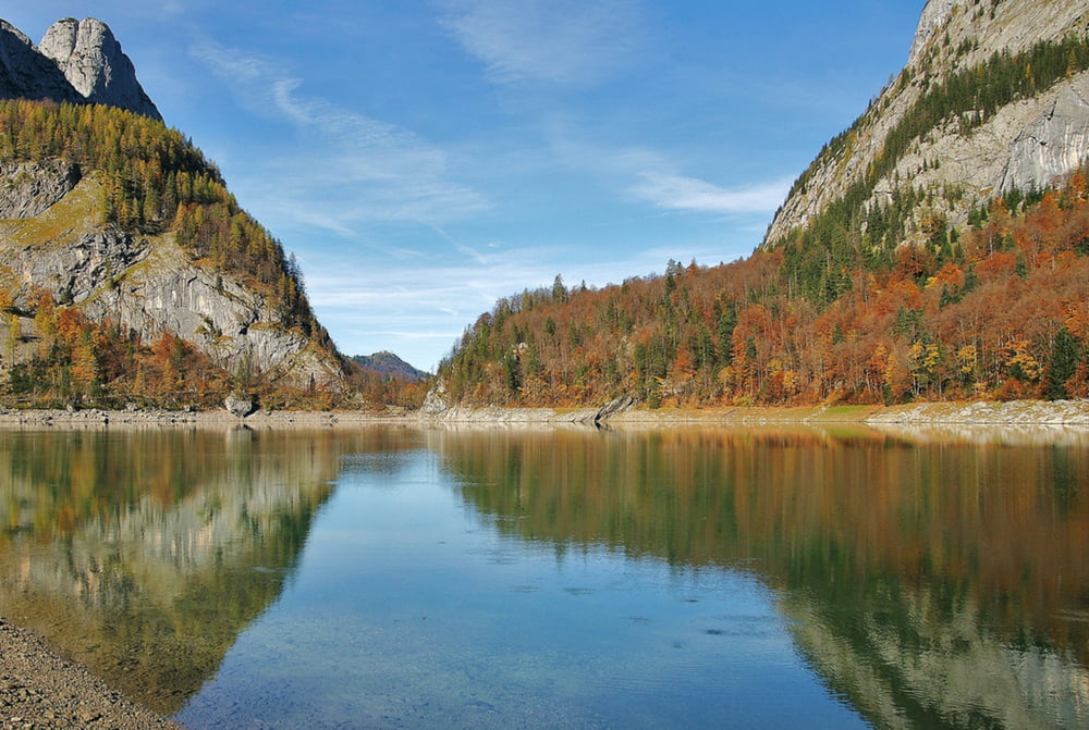
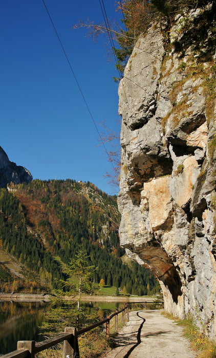
Die 14 Kilometer lange Halbtages Wanderung im Naturschutzgebiet Hallstatt-Dachstein hat nur 314 Höhenmeter. Vom Vorderen Gosausee, an der Gosaulacke vorbei bis zum Hinteren Gosausee kannst du das Wasser in seiner vielfältigen Art und Weise erleben. Obwohl die gesamte Tour auf einem Schotterweg verläuft sind Wander- oder Trekkingschuhe ratsam.

Weitere Infos und Fotos findest du auf biketours4you.at

Galeria trasy

Mapa trasy i profil wysokości

  • Open Street Map
  • Google
Minimum height 911 m Maximum height 1194 m Widok szczegółowy

More about the tour author

Trek1400d
Member since 2008

Send private message

Komentarze

GPS tracks

Trackpoints
  • GPX / Garmin Map Source (gpx) download
  • TCX / Garmin Training Center® (tcx) download
  • CRS / Garmin Training Center® (crs) download
  • Google Earth (kml) download
  • G7ToWin (g7t) download
  • TTQV (trk) download
  • Overlay (ovl) download
  • Fugawi (txt) download
  • Kompass (DAV) Track (tk) download
  • Karta trasy (pdf) download
  • Original file of the author (gpx) download

More about the tour author

Trek1400d
Member since 2008

Send private message
Share track
Add to my favorites
Remove from my favorites
Edit tags
My score
Rate
Trasa: Gosausee 2012
Rodzaj: Wędrówki
Długość: 14,0 km
Evaluated on:
Czas trwania:
Day(s)
Hour(s)
Minute(s)
Ocena: Krajobraz Czynnik zadowolenia Kondycja Technika