Login

Zapomniałeś swój login?

Cookies have to be accepted!
Your browser's cookie functionality is disabled. Please enable this functionality.

Not a member yet?

Register now
Login

Available for registred users only

Log in to use this feature.

Zapomniałeś swój login?

Cookies have to be accepted!
Your browser's cookie functionality is disabled. Please enable this functionality.

Not a member yet?

Register now
Filter
Kategorie
Advanced filters
  • Długość (km)
  • Wysokość
Zapisz filtr Reset filter

TrackRank

QRCode

Technical data

Długość50,6 km Wysokość817 m Way down838 m Czas trwania06:06 h:m Data22.10.2012
Oceny Author Krajobraz Czynnik zadowolenia Kondycja Technika

Statystyka

78 Widoki Oceny 3 Downloads / Pliki do pobrania Przeciętnie
Rate
  • Karta trasy
  • Dojazd
  • Downloads / Pliki do pobrania
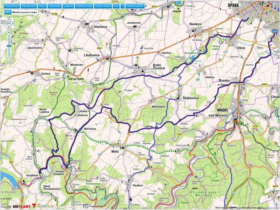
Kolis, Kajoš, Ševča, Major, Tom  - na gulášek dio Kružberka, díky barevnému podzimně letnímu dni jedna z nej vyjížděk roku.

Mapa trasy i profil wysokości

  • Open Street Map
  • Google
Minimum height 240 m Maximum height 566 m Widok szczegółowy

More about the tour author

mtbBen
Member since 2011

Send private message

Komentarze

GPS tracks

Trackpoints
  • GPX / Garmin Map Source (gpx) download
  • TCX / Garmin Training Center® (tcx) download
  • CRS / Garmin Training Center® (crs) download
  • Google Earth (kml) download
  • G7ToWin (g7t) download
  • TTQV (trk) download
  • Overlay (ovl) download
  • Fugawi (txt) download
  • Kompass (DAV) Track (tk) download
  • Karta trasy (pdf) download
  • Original file of the author (gpx) download

More about the tour author

mtbBen
Member since 2011

Send private message
Share track
Add to my favorites
Remove from my favorites
Edit tags
My score
Rate
Trasa: 20121021 zas ten Kružberk
Rodzaj: Rower górski (MTB)
Długość: 50,6 km
Evaluated on:
Czas trwania:
Day(s)
Hour(s)
Minute(s)
Ocena: Krajobraz Czynnik zadowolenia Kondycja Technika