

Viru Moor - Estland
Ein Wanderung auf Plankenwege im Naturschutzpark Lahemaa im Norden von Estland
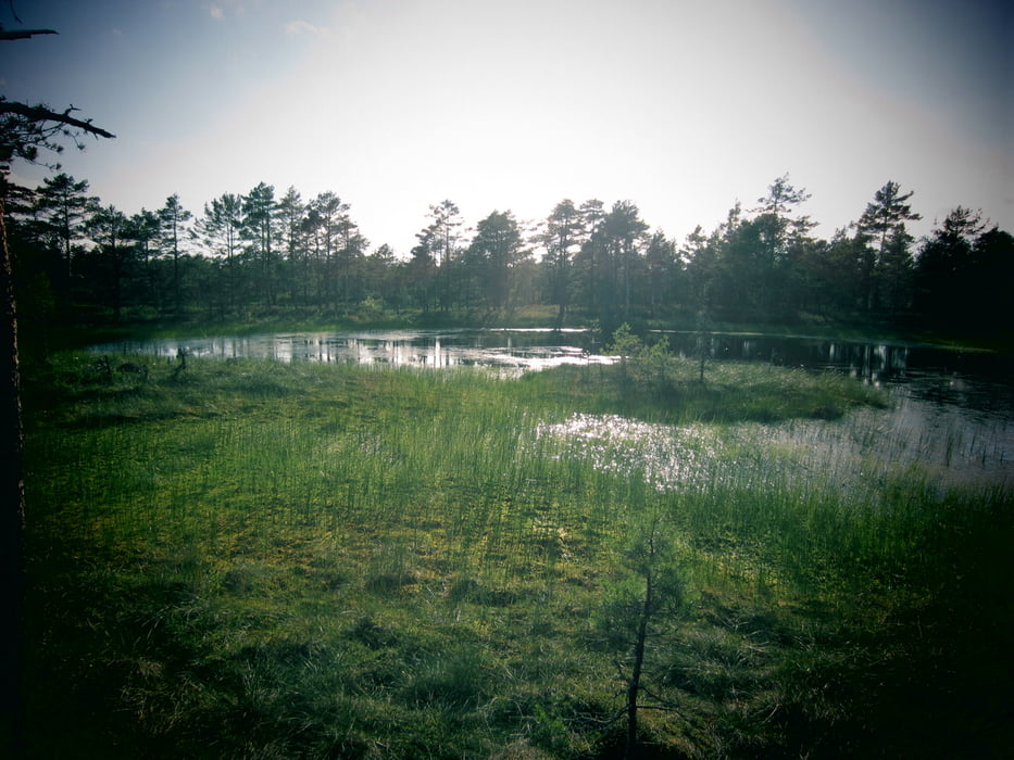
Eine Wanderung von 1,5 Std. auf einer Länge von 5,5km. Von der Landschaft her eine der schönsten Wanderungen in Estland. Zwar eine nur kurze Wanderung, jedoch am schönsten Punkt gibt es einen Aussichtsturm mit einem tollen Rundumblick. Gut mit einem Gelsenmittel einschmieren, die Plagegeister sind speziell dann wenn man in das Waldstück eintaucht sehr lästig.
Further information at
http://www.visitestonia.com/de/lehrpfad-des-hochmoores-viruGaleria trasy


Mapa trasy i profil wysokości
Minimum height 54 m
Maximum height 65 m
More about the tour author
|
|
der_Bergverfuehrer |
Komentarze

N59° 28.251' - E25° 38.194'
oder südöstlich von Kolga an der Straße 85, ein kleiner Parkplatz, hier beginnt der Rundwanderweg
GPS tracks
Trackpoints-
GPX / Garmin Map Source (gpx) download
-
TCX / Garmin Training Center® (tcx) download
-
CRS / Garmin Training Center® (crs) download
-
Google Earth (kml) download
-
G7ToWin (g7t) download
-
TTQV (trk) download
-
Overlay (ovl) download
-
Fugawi (txt) download
-
Kompass (DAV) Track (tk) download
-
Karta trasy (pdf) download
-
Original file of the author (gpx) download
More about the tour author
|
|
der_Bergverfuehrer |
Add to my favorites
Remove from my favorites
Edit tags
Open track
My score
Rate