Login

Zapomniałeś swój login?

Cookies have to be accepted!
Your browser's cookie functionality is disabled. Please enable this functionality.

Not a member yet?

Register now
Login

Available for registred users only

Log in to use this feature.

Zapomniałeś swój login?

Cookies have to be accepted!
Your browser's cookie functionality is disabled. Please enable this functionality.

Not a member yet?

Register now
Filter
Kategorie
Advanced filters
  • Długość (km)
  • Wysokość
Zapisz filtr Reset filter

TrackRank

QRCode

Technical data

Długość91,0 km Wysokość424 m Way down674 m Czas trwania1 day 4 h Data10.11.2012
Oceny Author Krajobraz Czynnik zadowolenia Kondycja Technika

Statystyka

254 Widoki Oceny 6 Downloads / Pliki do pobrania Przeciętnie
Rate
  • Karta trasy
  • Dojazd
  • Downloads / Pliki do pobrania
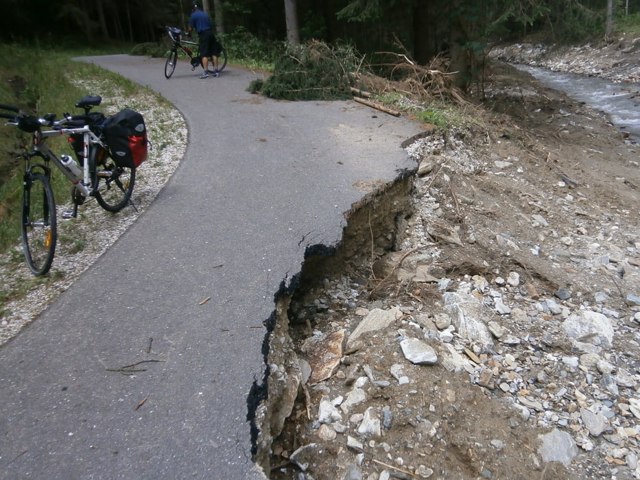
Es werden großteils Radwege und wenig befahrene Nebenstraßen benutzt. Im Juli 2012 war der Radweg zwischen Obdach und Reichenfels wegen Vermurung unpassierbar, Ausweichen auf die Bundesstraße möglich. Zwischen Twimberg und St. Gertraud steht nur die Bundesstraße zur Verfügung.

Galeria trasy

Mapa trasy i profil wysokości

  • Open Street Map
  • Google
Minimum height 345 m Maximum height 958 m Widok szczegółowy

More about the tour author

REDHAS
Member since 2010

Send private message

Komentarze

Ausgangspunkt mit der Bahn erreichbar. Von Lavamünd Fortsetzung über den Drau-Radweg möglich.

GPS tracks

Trackpoints
  • GPX / Garmin Map Source (gpx) download
  • TCX / Garmin Training Center® (tcx) download
  • CRS / Garmin Training Center® (crs) download
  • Google Earth (kml) download
  • G7ToWin (g7t) download
  • TTQV (trk) download
  • Overlay (ovl) download
  • Fugawi (txt) download
  • Kompass (DAV) Track (tk) download
  • Karta trasy (pdf) download
  • Original file of the author (gpx) download

More about the tour author

REDHAS
Member since 2010

Send private message
Share track
Add to my favorites
Remove from my favorites
Edit tags
My score
Rate
Trasa: Lavanttal
Rodzaj: Rower trekkingowy
Długość: 91,0 km
Evaluated on:
Czas trwania:
Day(s)
Hour(s)
Minute(s)
Ocena: Krajobraz Czynnik zadowolenia Kondycja Technika