


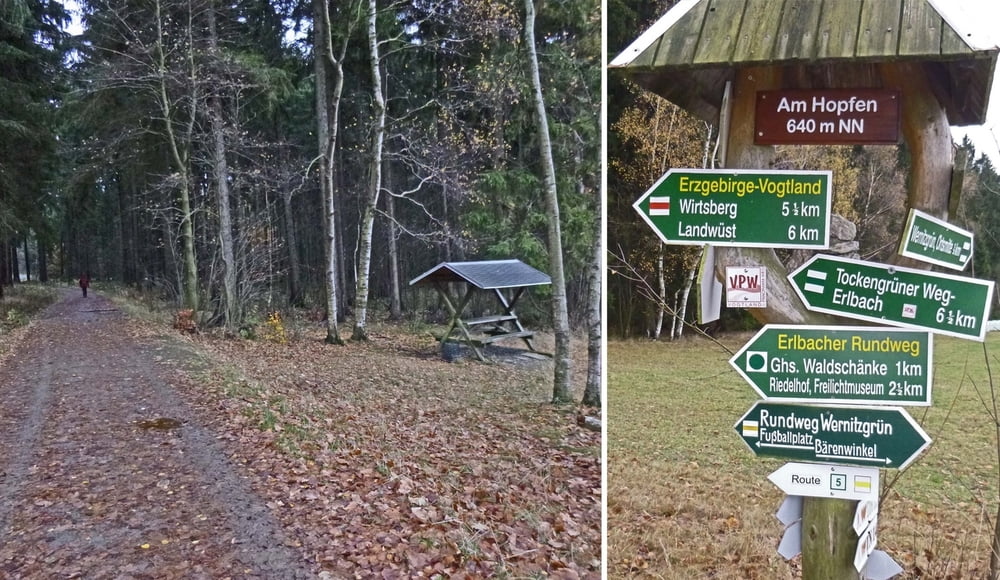
Bequeme Kurzwanderung durch das hügelige Obere Vogtland als offizieller „Rundweg Wernitzgrün“. Vorwiegend geschotterte sowie teilweise naturbelassene und grasbewachsene Wege. Tour ohne Einkehrmöglichkeit an der Strecke.
Auf diesen sowie zwei modifizierte Tracks mit den Wegpunkten zur Beschreibung (Parken, Wegweiser, Bänke, Fotos zur Wegbeschaffenheit) kann zugegriffen werden über http://www.wolf-klepzig.de/hp/wandg/WernitzgruenerRndvariant.gpx. Die ausführliche Tourenbeschreibung der drei Tracks steht unter http://www.wolf-klepzig.de/hp/wandg/Wernitzgruen_Rundweg_Acht_Schleife.pdf.
Further information at
http://www.wolf-klepzig.de/hp/wandern.htmGaleria trasy


Mapa trasy i profil wysokości
Minimum height 574 m
Maximum height 658 m
More about the tour author

|
klegpst |
Komentarze

Anfahrt:
Von A72 Ausfahrt 6, Plauen-Süd auf B92/E49 in Richtung Bad Brambach/Bad Elster/Oelsnitz i.V. > in Adorf von B92 links auf B283 Richtung Markneukirchen > Markneukirchen Umgehungsstraße B283 > scharf rechts auf Klingenthaler Straße > nach 550 m links auf Bismarkstraße > nach 300 m links auf Schützenstraße > Wernitzgrüner Straße bis Wernitzgrün > Zollstraße bis zum Parkplatz am Sportplatz.
Zieleingabe für Routenplaner Zollstraße 23, 08265 Erlbach oder die Parkplatzkoordinaten N50° 17’ 13,0’’ E12° 22’ 12,3’’, bei Google Earth und Google Maps ohne die Einheiten für Grad, Minute und Sekunde.
Parken:
Kleiner Parkplatz neben der Zollstraße am Sportplatz, Koordinaten N50 17 13.0 E12 22 04.5.
GPS tracks
Trackpoints-
GPX / Garmin Map Source (gpx) download
-
TCX / Garmin Training Center® (tcx) download
-
CRS / Garmin Training Center® (crs) download
-
Google Earth (kml) download
-
G7ToWin (g7t) download
-
TTQV (trk) download
-
Overlay (ovl) download
-
Fugawi (txt) download
-
Kompass (DAV) Track (tk) download
-
Karta trasy (pdf) download
-
Original file of the author (gpx) download
More about the tour author
|
|
klegpst |
Add to my favorites
Remove from my favorites
Edit tags
Open track
My score
Rate