Login

Zapomniałeś swój login?

Cookies have to be accepted!
Your browser's cookie functionality is disabled. Please enable this functionality.

Not a member yet?

Register now
Login

Available for registred users only

Log in to use this feature.

Zapomniałeś swój login?

Cookies have to be accepted!
Your browser's cookie functionality is disabled. Please enable this functionality.

Not a member yet?

Register now
Filter
Kategorie
Advanced filters
  • Długość (km)
  • Wysokość
Zapisz filtr Reset filter

TrackRank

QRCode

Technical data

Długość46,5 km Wysokość1841 m Way down1804 m Czas trwania05:23 h:m Data14.12.2012
Oceny Author Krajobraz Czynnik zadowolenia Kondycja Technika

Statystyka

1122 Widoki Oceny 171 Downloads / Pliki do pobrania Przeciętnie
Rate
  • Karta trasy
  • Dojazd
  • Downloads / Pliki do pobrania
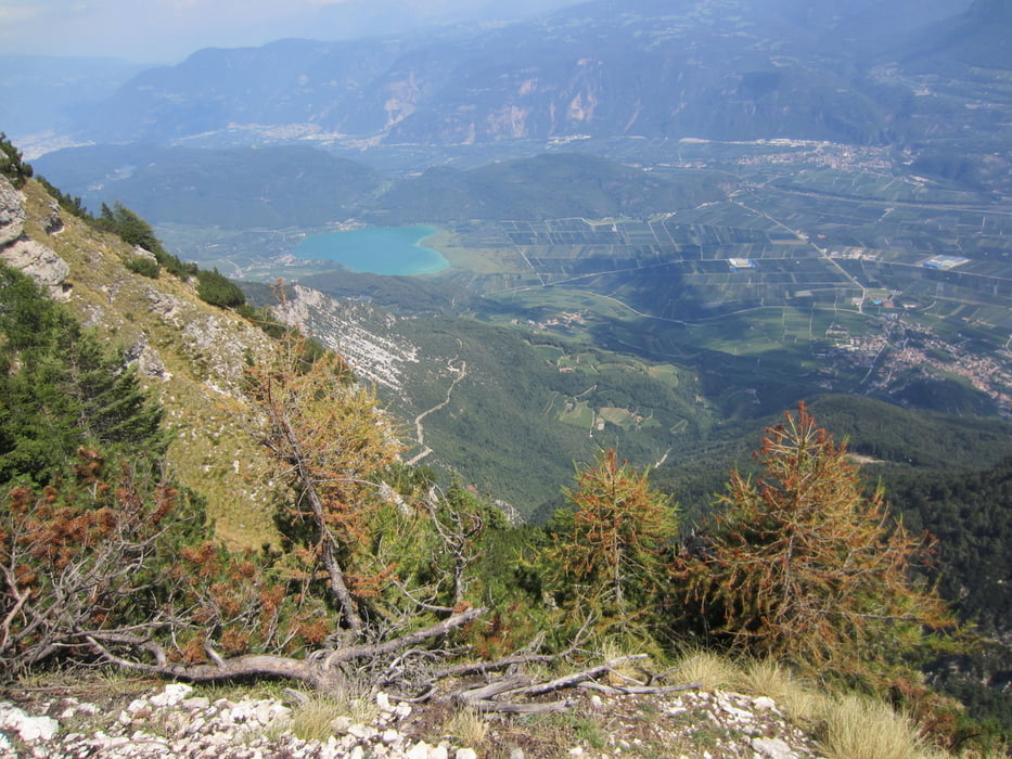
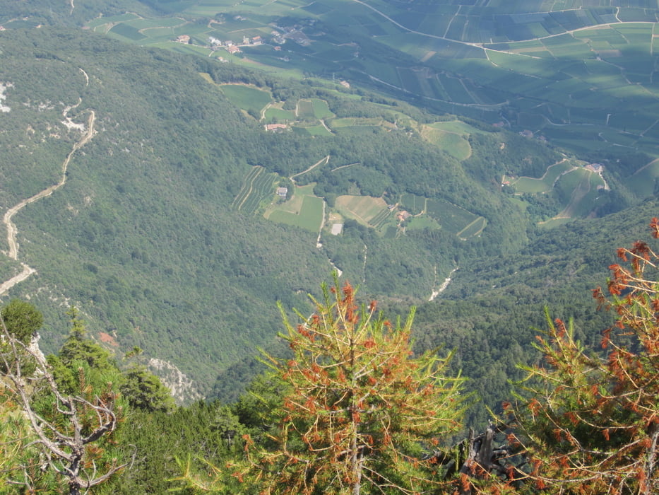
  • Anstrengende Tour mit herrlichem Panoramablick auf den Kalterer-See und das Unterland.
  • Einige kurze, steile Anstiege.
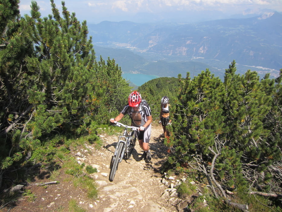
  • Vor dem Gipfel ca. 200 mt. Schiebe-bzw. Tragepassage.
  • Vom Mendelpass Abfahrt auf der geteerten Passtrasse.


  • START/ZIEL: Sportzone Kaltern


NB. FAHRTRICHTUNG IM  UHRZEIGERSINN.

Galeria trasy

Mapa trasy i profil wysokości

  • Open Street Map
  • Google
Minimum height 503 m Maximum height 2110 m Widok szczegółowy

More about the tour author

MargesinFriedrich
Member since 2012

Send private message

Komentarze

Von Bozen nach Kaltern/Sportzone oberhalb von Kaltern.

GPS tracks

Trackpoints
  • GPX / Garmin Map Source (gpx) download
  • TCX / Garmin Training Center® (tcx) download
  • CRS / Garmin Training Center® (crs) download
  • Google Earth (kml) download
  • G7ToWin (g7t) download
  • TTQV (trk) download
  • Overlay (ovl) download
  • Fugawi (txt) download
  • Kompass (DAV) Track (tk) download
  • Karta trasy (pdf) download
  • Original file of the author (gpx) download

More about the tour author

MargesinFriedrich
Member since 2012

Send private message
Share track
Add to my favorites
Remove from my favorites
Edit tags
My score
Rate
Trasa: Kaltern-Monte Roen-Mendel-Kaltern
Rodzaj: Rower górski (MTB)
Długość: 46,5 km
Evaluated on:
Czas trwania:
Day(s)
Hour(s)
Minute(s)
Ocena: Krajobraz Czynnik zadowolenia Kondycja Technika