
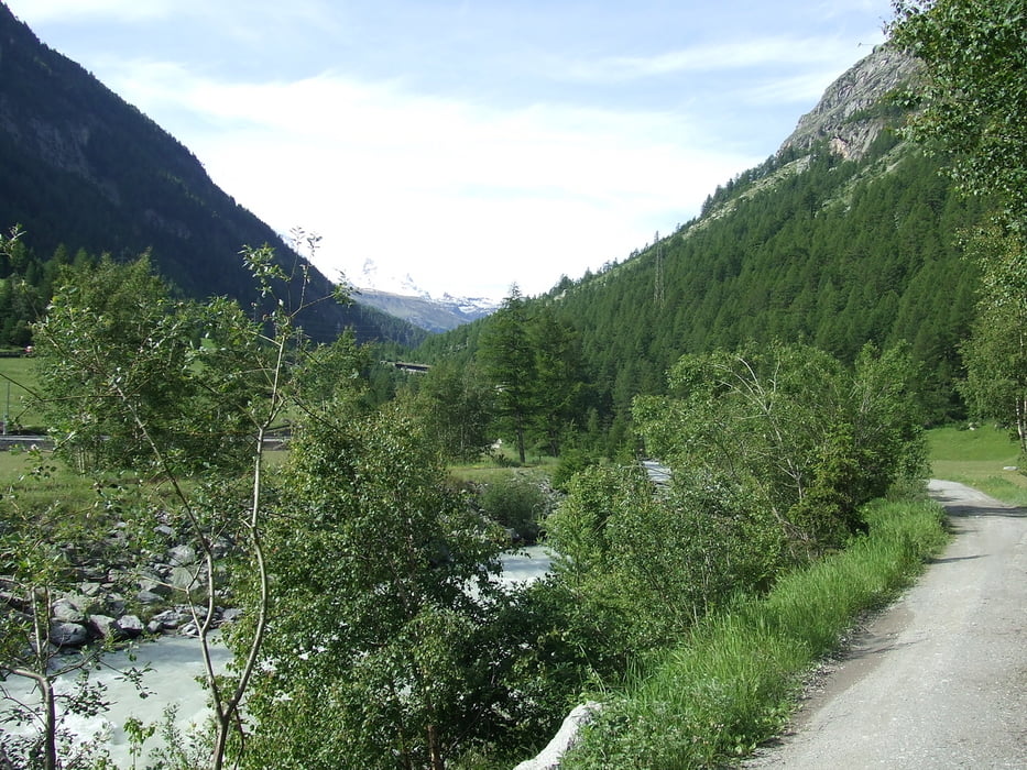

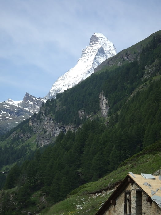
Zermatt ist nur mit Taxi,Bahn und zu Fuß erreichbar. Vom Bahnhof Täsch zum Bahnhof Zermatt (natürlich auch umgekehrt) gibt es einen schönen Wanderweg. Am Bahnhof Täsch parken wir und überquer die Visp. An Ihr gehts eben auf einem Wirtschaftseweg an einem Campingplatz und an der Felsenkapelle vorbei. Das Tal wird enger und der Weg steiler und schöner . Von hieraus bis kurz vor Zermatt kann man garantiert Murmels und mit Glück auch Rehe und Gemse beobachten. Nachdem wir die Basis von Air-Zermatt passiert haben sehen wir Zermatt vor uns liegen.
Galeria trasy


Mapa trasy i profil wysokości
Minimum height 1427 m
Maximum height 1628 m
More about the tour author

|
civap |
Komentarze

Das Mattertal bis zum Ende durchfahren und einen Parkplatz auf der Wiese oder im Parkhaus (Hotels oder Bahnhof) suchen.
Neue Kantonsstrasse
3929 Täsch, Schweiz
46.068839, 7.775313
+46° 4' 7.82", +7° 46' 31.13"
GPS tracks
Trackpoints-
GPX / Garmin Map Source (gpx) download
-
TCX / Garmin Training Center® (tcx) download
-
CRS / Garmin Training Center® (crs) download
-
Google Earth (kml) download
-
G7ToWin (g7t) download
-
TTQV (trk) download
-
Overlay (ovl) download
-
Fugawi (txt) download
-
Kompass (DAV) Track (tk) download
-
Karta trasy (pdf) download
-
Original file of the author (gpx) download
More about the tour author
|
|
civap |
Add to my favorites
Remove from my favorites
Edit tags
Open track
My score
Rate