

Anfangs kurzer Abschnitt auf Wander-/MTB-Strecke zur Straße SP118, auf dieser weiter nach Panzano. Über Santa Maria a Grignano nach Radda und über Valico del Morellino (747 m über NN) und Greve zurück zum Ausgangspunkt.
Zu Beginn im Abstieg wie im Anstieg auf steilem und steinigem Wander-/MTB-Weg (evtl. kurze Abschnitte schieben; alternativ könnte die Straße (SP26) genutzt werden). Rest der Strecke asphaltierte oder schottrigen Nebenstraßen.
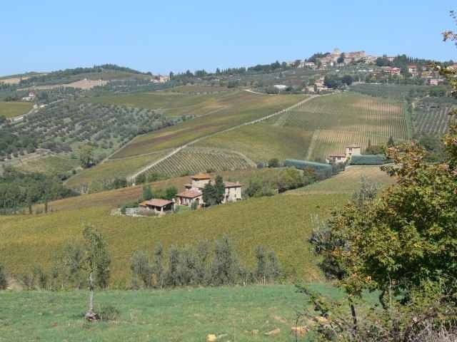
Insgesamt unschwierig, landschaftlich sehr reizvoll,
Besichtigung des kleinen Ortes Montefioralle sehr zu empfehlen.
Zu Beginn im Abstieg wie im Anstieg auf steilem und steinigem Wander-/MTB-Weg (evtl. kurze Abschnitte schieben; alternativ könnte die Straße (SP26) genutzt werden). Rest der Strecke asphaltierte oder schottrigen Nebenstraßen.
Insgesamt unschwierig, landschaftlich sehr reizvoll,
Besichtigung des kleinen Ortes Montefioralle sehr zu empfehlen.
Further information at
http://www.greve-in-chianti.com/Galeria trasy

Mapa trasy i profil wysokości
Minimum height 234 m
Maximum height 749 m
More about the tour author

|
LöhndorfBiker |
Komentarze

Mit dem PKW nach Montefioralle bei Greve. Parken auf Parkplatz vor dem Ort.
GPS tracks
Trackpoints-
GPX / Garmin Map Source (gpx) download
-
TCX / Garmin Training Center® (tcx) download
-
CRS / Garmin Training Center® (crs) download
-
Google Earth (kml) download
-
G7ToWin (g7t) download
-
TTQV (trk) download
-
Overlay (ovl) download
-
Fugawi (txt) download
-
Kompass (DAV) Track (tk) download
-
Karta trasy (pdf) download
-
Original file of the author (gpx) download
More about the tour author
|
|
LöhndorfBiker |
Add to my favorites
Remove from my favorites
Edit tags
Open track
My score
Rate