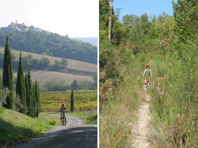
Diese Tour in traumhafter Landschaft mit tollen Ausblicken führt fast ausschließlich auf asphaltlosen Wegen, teilweise Singletrails, teilweise auch steil bergauf/bergab. Je nach Gusto wird frau/mann einzelne kurze Passagen evtl. schieben, was aber in Anbetracht der tollen Landschaft/Ausblicke und der insgesamt recht kurzen Strecke aber leicht zu verschmerzen ist.
Der Weg führt über San Donato (nettes Weingut) und Santa Lucia und die Ausläufer von San Gimignano zurück zum Ausgangspunkt.
Die Tour lässt sich gut durch Tour 11773 verlängern.
Der Weg führt über San Donato (nettes Weingut) und Santa Lucia und die Ausläufer von San Gimignano zurück zum Ausgangspunkt.
Die Tour lässt sich gut durch Tour 11773 verlängern.
Further information at
http://www.san-gimignano.com/Galeria trasy
Mapa trasy i profil wysokości
Minimum height 112 m
Maximum height 371 m
Komentarze
Über die SP47 von Süden, SP1 vom Norden oder Osten. Parken an der SP47 (von San Gimignano aus kommend noch vor dem großen Busparkplatz) oder irgendwo an der Strecke (siehe GPS-Daten).
GPS tracks
Trackpoints-
GPX / Garmin Map Source (gpx) download
-
TCX / Garmin Training Center® (tcx) download
-
CRS / Garmin Training Center® (crs) download
-
Google Earth (kml) download
-
G7ToWin (g7t) download
-
TTQV (trk) download
-
Overlay (ovl) download
-
Fugawi (txt) download
-
Kompass (DAV) Track (tk) download
-
Karta trasy (pdf) download
-
Original file of the author (gpx) download
Add to my favorites
Remove from my favorites
Edit tags
Open track
My score
Rate


San Gimignano - südliche Runde