Login

Zapomniałeś swój login?

Cookies have to be accepted!
Your browser's cookie functionality is disabled. Please enable this functionality.

Not a member yet?

Register now
Login

Available for registred users only

Log in to use this feature.

Zapomniałeś swój login?

Cookies have to be accepted!
Your browser's cookie functionality is disabled. Please enable this functionality.

Not a member yet?

Register now
Filter
Kategorie
Advanced filters
  • Długość (km)
  • Wysokość
Zapisz filtr Reset filter

TrackRank

QRCode

Technical data

Długość108,0 km Wysokość2026 m Way down2248 m Czas trwania06:00 h:m Data23.05.2013
Oceny Author Krajobraz Czynnik zadowolenia Kondycja Technika

Statystyka

499 Widoki Oceny 112 Downloads / Pliki do pobrania Przeciętnie
Rate
  • Karta trasy
  • Dojazd
  • Downloads / Pliki do pobrania

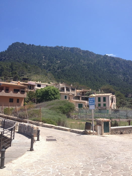
Tag 2. Diese Tour stellte sich für mich als Königsetappe dar. Es ging über Calvia und Puigpunyent nach Valldemossa. Wir sind aber nicht in den Ort sondern runter nach Port de Valldemossa. Die Abfahrt offenbarte schlimmes, enge Kurven und raue Belag wird von durchschnittlich 10% begleitet.

Nach einer Stärkung ging es wieder hinauf. Die Küstenstraße zurück nach Andratx lässt sich sehr gut fahren, zieht aber durch das ständige Auf und Ab die Kraft aus den Beinen.


Mapa trasy i profil wysokości

  • Open Street Map
  • Google
Minimum height 1 m Maximum height 489 m Widok szczegółowy

More about the tour author

dorian357
Member since 2009

Send private message

Komentarze

GPS tracks

Trackpoints
  • GPX / Garmin Map Source (gpx) download
  • TCX / Garmin Training Center® (tcx) download
  • CRS / Garmin Training Center® (crs) download
  • Google Earth (kml) download
  • G7ToWin (g7t) download
  • TTQV (trk) download
  • Overlay (ovl) download
  • Fugawi (txt) download
  • Kompass (DAV) Track (tk) download
  • Karta trasy (pdf) download
  • Original file of the author (gpx) download

More about the tour author

dorian357
Member since 2009

Send private message
Share track
Add to my favorites
Remove from my favorites
Edit tags
My score
Rate
Trasa: Mallorca 2013-Tag 2
Rodzaj: Rower szosowy
Długość: 108,0 km
Evaluated on:
Czas trwania:
Day(s)
Hour(s)
Minute(s)
Ocena: Krajobraz Czynnik zadowolenia Kondycja Technika