Login

Zapomniałeś swój login?

Cookies have to be accepted!
Your browser's cookie functionality is disabled. Please enable this functionality.

Not a member yet?

Register now
Login

Available for registred users only

Log in to use this feature.

Zapomniałeś swój login?

Cookies have to be accepted!
Your browser's cookie functionality is disabled. Please enable this functionality.

Not a member yet?

Register now
Filter
Kategorie
Advanced filters
  • Długość (km)
  • Wysokość
Zapisz filtr Reset filter

TrackRank

QRCode

Technical data

Długość39,6 km Wysokość914 m Way down948 m Czas trwania00:00 h:m Data18.10.2007
Oceny Author Krajobraz Czynnik zadowolenia Kondycja Technika

Statystyka

369 Widoki Oceny 67 Downloads / Pliki do pobrania Przeciętnie
Rate
  • Karta trasy
  • Dojazd
  • Downloads / Pliki do pobrania
Rundkurs.
Parken kann man in Gothic vor der Ortschaft.
Dann auf dem Forstweg zurück nach Crested Butte.
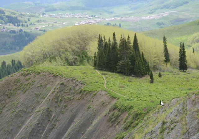
Schöne Tour, zum Teil auf Forstwegen und viel Trailanteil

Mapa trasy i profil wysokości

  • Open Street Map
  • Google
Minimum height 2732 m Maximum height 3240 m Widok szczegółowy

More about the tour author

RandB
Member since 2006

Send private message

Komentarze

GPS tracks

Trackpoints
  • GPX / Garmin Map Source (gpx) download
  • TCX / Garmin Training Center® (tcx) download
  • CRS / Garmin Training Center® (crs) download
  • Google Earth (kml) download
  • G7ToWin (g7t) download
  • TTQV (trk) download
  • Overlay (ovl) download
  • Fugawi (txt) download
  • Kompass (DAV) Track (tk) download
  • Karta trasy (pdf) download
  • Original file of the author (gpx) download

More about the tour author

RandB
Member since 2006

Send private message
Share track
Add to my favorites
Remove from my favorites
Edit tags
My score
Rate
Trasa: Crested Butte / Rundkurs
Rodzaj: Rower górski (MTB)
Długość: 39,6 km
Evaluated on:
Czas trwania:
Day(s)
Hour(s)
Minute(s)
Ocena: Krajobraz Czynnik zadowolenia Kondycja Technika