Login

Zapomniałeś swój login?

Cookies have to be accepted!
Your browser's cookie functionality is disabled. Please enable this functionality.

Not a member yet?

Register now
Login

Available for registred users only

Log in to use this feature.

Zapomniałeś swój login?

Cookies have to be accepted!
Your browser's cookie functionality is disabled. Please enable this functionality.

Not a member yet?

Register now
Filter
Kategorie
Advanced filters
  • Długość (km)
  • Wysokość
Zapisz filtr Reset filter

TrackRank

QRCode

Technical data

Długość44,7 km Wysokość1359 m Way down1359 m Czas trwania04:10 h:m Data20.06.2013
Oceny Author User Krajobraz Czynnik zadowolenia Kondycja Technika

Statystyka

2351 Widoki 2 Oceny 641 Downloads / Pliki do pobrania 4.50 Przeciętnie
Rate
  • Karta trasy
  • Dojazd
  • Downloads / Pliki do pobrania

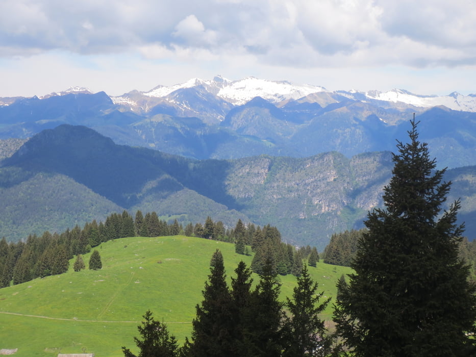
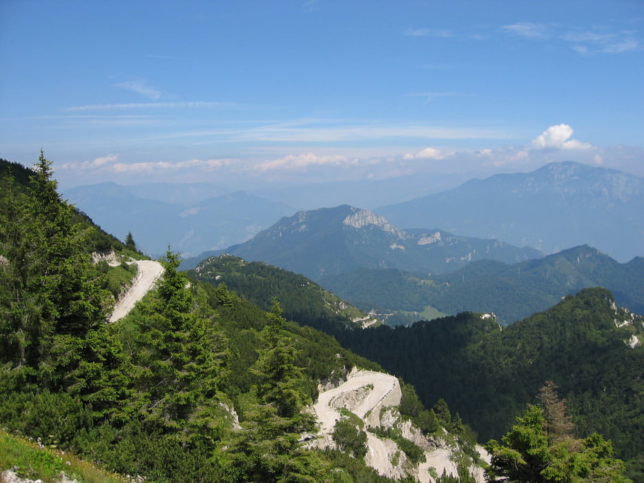
Wir fahren von  Molina di Ledro am linken Seeufer entlang bis Pieve. Weiter geht es auf Radwegen und wenig gefahrenen Straßen bis zum Lago di Ampola. Nun geht es auf der wenig befahrenen Tremalzostraße ca 1000 m hoch bis zum Rif.Garda und noch mal 100 m auf Schotter bis zum höchsten Punkt der Tour dem 1.Tremalzotunnel.Was jetzt folgt ist der Lohn für den Aufstieg. Ca 600 m tolle Abfahrt bis zum P.so Nota,weiter bergauf und ab bis zur Bocca dei Fortini und zum teil steil bergab wieder an den Ledrosee.

Einkehrmöglichkeiten: Rif.Garda und die Hütte am P.so Nota

Die Tremalzotour mit dem leichtesten Anstieg und ohne große technische Anforderungen.

Galeria trasy

Mapa trasy i profil wysokości

  • Open Street Map
  • Google
Minimum height 650 m Maximum height 1832 m Widok szczegółowy

More about the tour author

baumgarten
Member since 2010

Send private message

Komentarze

Daniel82 on 20.07.2013

Schöne Tour

Der Tremalzo steht bei mir 2013 auch noch auf dem Programm. Deine Tour hat mir bei der Planung schon mal gut weiter geholfen.

GPS tracks

Trackpoints
  • GPX / Garmin Map Source (gpx) download
  • TCX / Garmin Training Center® (tcx) download
  • CRS / Garmin Training Center® (crs) download
  • Google Earth (kml) download
  • G7ToWin (g7t) download
  • TTQV (trk) download
  • Overlay (ovl) download
  • Fugawi (txt) download
  • Kompass (DAV) Track (tk) download
  • Karta trasy (pdf) download
  • Original file of the author (gpx) download

More about the tour author

baumgarten
Member since 2010

Send private message
Share track
Add to my favorites
Remove from my favorites
Edit tags
My score
Rate
Trasa: Vom Ledrosee auf den Tremalzo
Rodzaj: Rower górski (MTB)
Długość: 44,7 km
Evaluated on:
Czas trwania:
Day(s)
Hour(s)
Minute(s)
Ocena: Krajobraz Czynnik zadowolenia Kondycja Technika