

Tag 3
Über den Bettlersteig zur Kaindlhütte
Ausgangspunkt:
Stripsenjochhaus (1577 m)
Weg:
Stripsenjochhaus - Kaisertalhaus - Hinterbärenbad - Straßwalch-J.H. - Bettlersteig - Kaindlhütte (1293 m)
Tourdaten:
Entfernung 10 Km, ca. 7 Std mit Einkehr im Anton-Karg-Haus
Unterbringung:
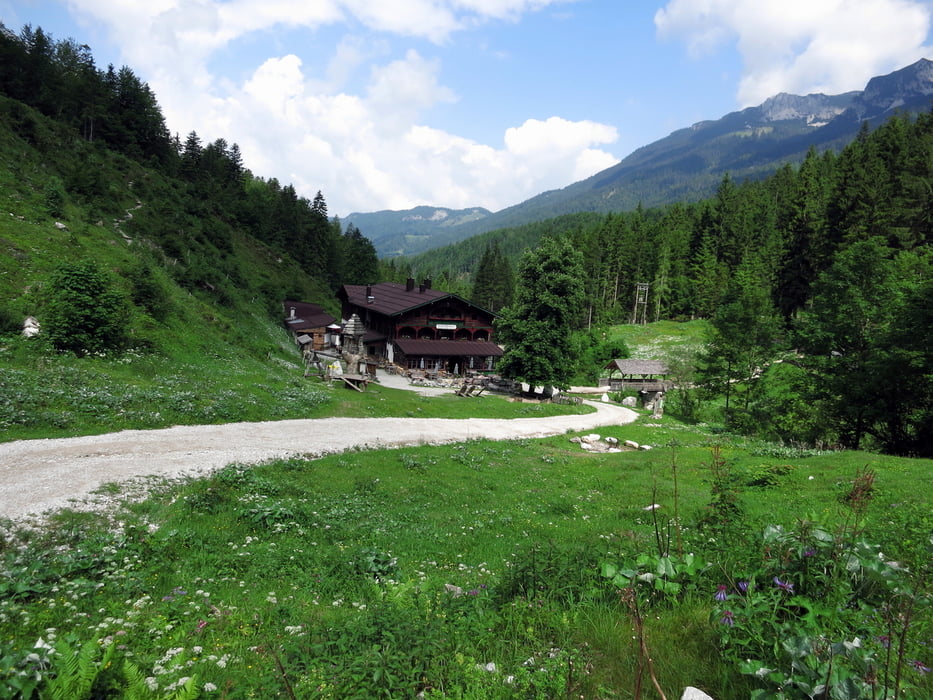
Kaindlhütte: 32 € mit Frühstück pro Person (Zweibettzimmer mit frischer Bettwäsche!)
Die Kaindlhütte gehört nicht zum Alpenverein und wird privat geführt. Das Haus wurde 1902 errichtet und wird traditionell bewirtschaften. Pur und ein bisserl altmodisch, aber sehr gepflegt und richtig familiär; keine Rundumbeschallung mit Fremdenverkehrsmusik, kein Fernsehen und nur schlechter Handyempfang, dafür Bergblick, Kuhglocken, und Alpenblumen! Die Küche war einfach traumhaft **** ; regionale Küchentradition.
Further information at
http://kaindlhuette.com/Galeria trasy


Mapa trasy i profil wysokości
Minimum height 829 m
Maximum height 1622 m
More about the tour author

|
vogelsang38 |
Komentarze

Kufstein, Ortsteil Sparchen (496 m), Parkplatz am Eingang ins Kaisertal
GPS tracks
Trackpoints-
GPX / Garmin Map Source (gpx) download
-
TCX / Garmin Training Center® (tcx) download
-
CRS / Garmin Training Center® (crs) download
-
Google Earth (kml) download
-
G7ToWin (g7t) download
-
TTQV (trk) download
-
Overlay (ovl) download
-
Fugawi (txt) download
-
Kompass (DAV) Track (tk) download
-
Karta trasy (pdf) download
-
Original file of the author (gpx) download
More about the tour author
|
|
vogelsang38 |
Add to my favorites
Remove from my favorites
Edit tags
Open track
My score
Rate