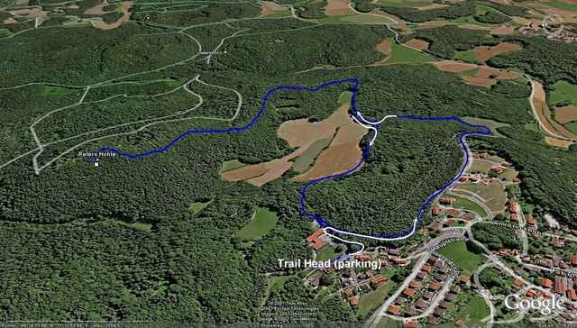
This is a very short (3 mile loop) with options. Single track follows ridge line to interesting small cave (bring a light and explore with consideration and care). Return from cave follows same ridge line (it's just too fun). Take care on ridge... some exposure. 3 hour tour includes average time for exploring cave.
Mapa trasy i profil wysokości
Minimum height 382 m
Maximum height 543 m
Komentarze

GPS tracks
Trackpoints-
GPX / Garmin Map Source (gpx) download
-
TCX / Garmin Training Center® (tcx) download
-
CRS / Garmin Training Center® (crs) download
-
Google Earth (kml) download
-
G7ToWin (g7t) download
-
TTQV (trk) download
-
Overlay (ovl) download
-
Fugawi (txt) download
-
Kompass (DAV) Track (tk) download
-
Karta trasy (pdf) download
-
Original file of the author (gpx) download
Add to my favorites
Remove from my favorites
Edit tags
Open track
My score
Rate


