


Leichte Wanderung auf meist asphaltierten Wegen. Zuerst geht’s
hoch durch ein Wohngebiet bis zur Solarstation. Dann weiter bis zum
Delcherhof. Nun noch ein Stück hoch zum Scheidterhof.
Links ab durch die Hofanlagen hinunter zum Kerberbachtal.
Über den Bach und wieder hinauf Richtung Dreckenach.
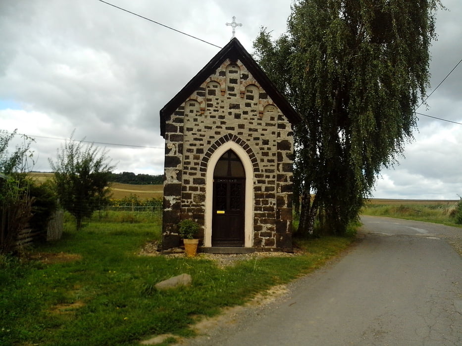
Vorbei an der Steine Kreuz Hütte geht’s wieder zurück nach Kobern Gondorf.
Further information at
http://www.koberngondorf.deGaleria trasy


Mapa trasy i profil wysokości
Minimum height 82 m
Maximum height 224 m
More about the tour author
|
|
lahnwinni |
Komentarze
Von Koblenz kommend auf der B 49 Richtung Treis Karden.
Hinter Dieblich links ab über die Brücke nach Kobern Gondorf.
Die Brücke bis zum Ende fahren (180 Grad Linkskurve).Am Ende
fährt man auf die Bahngleise zu. Direkt neben den Gleisen haben
wir unser Auto abgestellt.
Hinter Dieblich links ab über die Brücke nach Kobern Gondorf.
Die Brücke bis zum Ende fahren (180 Grad Linkskurve).Am Ende
fährt man auf die Bahngleise zu. Direkt neben den Gleisen haben
wir unser Auto abgestellt.
GPS tracks
Trackpoints-
GPX / Garmin Map Source (gpx) download
-
TCX / Garmin Training Center® (tcx) download
-
CRS / Garmin Training Center® (crs) download
-
Google Earth (kml) download
-
G7ToWin (g7t) download
-
TTQV (trk) download
-
Overlay (ovl) download
-
Fugawi (txt) download
-
Kompass (DAV) Track (tk) download
-
Karta trasy (pdf) download
-
Original file of the author (gpx) download
More about the tour author
|
|
lahnwinni |
Add to my favorites
Remove from my favorites
Edit tags
Open track
My score
Rate
Asphaltierte Wege