Login

Zapomniałeś swój login?

Cookies have to be accepted!
Your browser's cookie functionality is disabled. Please enable this functionality.

Not a member yet?

Register now
Login

Available for registred users only

Log in to use this feature.

Zapomniałeś swój login?

Cookies have to be accepted!
Your browser's cookie functionality is disabled. Please enable this functionality.

Not a member yet?

Register now
Filter
Kategorie
Advanced filters
  • Długość (km)
  • Wysokość
Zapisz filtr Reset filter

TrackRank

QRCode

Technical data

Długość119,6 km Wysokość2743 m Way down3113 m Czas trwania00:00 h:m Data09.08.2013
Oceny Author Krajobraz Czynnik zadowolenia Kondycja Technika

Statystyka

243 Widoki Oceny 9 Downloads / Pliki do pobrania Przeciętnie
Rate
  • Karta trasy
  • Dojazd
  • Downloads / Pliki do pobrania

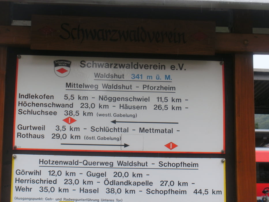
Mittelweg geht von Pforzheim nach Waldshut.

Mein Sohn 13 Jahre und Ich 47 Jahre sin in 4 Tagen von Lauterbach mach Waldshut gewandert

Galeria trasy

Mapa trasy i profil wysokości

  • Open Street Map
  • Google
Minimum height 344 m Maximum height 1201 m Widok szczegółowy

More about the tour author

manfred.seckinger
Member since 2007

Send private message

Komentarze

GPS tracks

Trackpoints
  • GPX / Garmin Map Source (gpx) download
  • TCX / Garmin Training Center® (tcx) download
  • CRS / Garmin Training Center® (crs) download
  • Google Earth (kml) download
  • G7ToWin (g7t) download
  • TTQV (trk) download
  • Overlay (ovl) download
  • Fugawi (txt) download
  • Kompass (DAV) Track (tk) download
  • Karta trasy (pdf) download
  • Original file of the author (gpx) download

More about the tour author

manfred.seckinger
Member since 2007

Send private message
Share track
Add to my favorites
Remove from my favorites
Edit tags
My score
Rate
Trasa: Mittelweg von Lauterbach nach Waldshut über Schluchsee
Rodzaj: Wędrówki
Długość: 119,6 km
Evaluated on:
Czas trwania:
Day(s)
Hour(s)
Minute(s)
Ocena: Krajobraz Czynnik zadowolenia Kondycja Technika