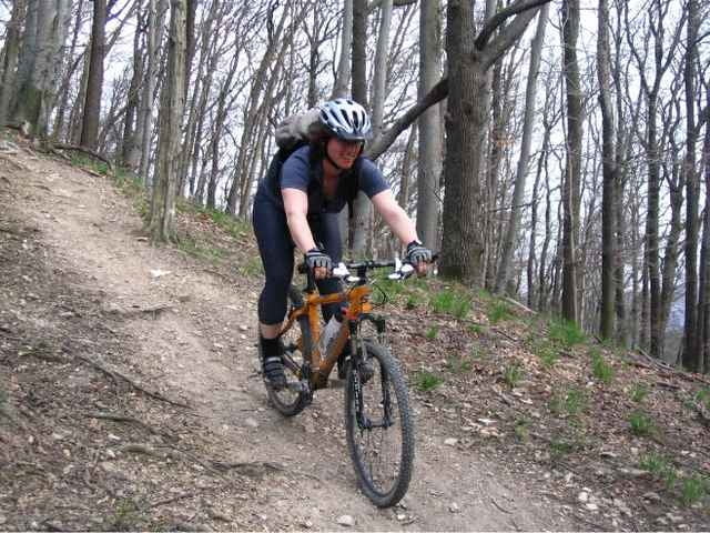
Diese Rundstrecke im Westen Wiens ist für jene gedacht, denen die zahlreichen beschilderten Mountainbikestrecken um Wien technisch zu wenig reizvoll sind.
Die Route führt vom Bahnhof Hütteldorf Richtung Dehnepark, weiter Richtung Mauerbach, über Sophienalpe, Exelberg (516m = höchster Punkt) und Jubiläumswarte wieder zurück nach Hütteldorf. Zum Großteil werden dabei kleine Wanderwege und nette Singletrails befahren, rassige Abfahrten wechseln mit kernigen Anstiegen. Die Abfahrten sind stellenweise anspruchsvoll, für erfahrene Mountainbiker aber alle fahrbar.
Der überwiegende Teil der Strecke führt im Buchenwald, dh die Tour ist auch an heißen Sommertagen sinnvoll. (Der GPS Empfang im belaubten Wald ist dann allerdings nicht so gut!)
Further information at
http://www.bike-gruppe.atGaleria trasy
Mapa trasy i profil wysokości
Minimum height 227 m
Maximum height 513 m
Komentarze
Ausgangspunkt ist der Bahnhof Hütteldorf, erreichbar mit U4, Bus, Bahn und PKW
GPS tracks
Trackpoints-
GPX / Garmin Map Source (gpx) download
-
TCX / Garmin Training Center® (tcx) download
-
CRS / Garmin Training Center® (crs) download
-
Google Earth (kml) download
-
G7ToWin (g7t) download
-
TTQV (trk) download
-
Overlay (ovl) download
-
Fugawi (txt) download
-
Kompass (DAV) Track (tk) download
-
Karta trasy (pdf) download
-
Original file of the author (g7t) download
Add to my favorites
Remove from my favorites
Edit tags
Open track
My score
Rate


Gut
Teilweise...