

Start in Altdorf
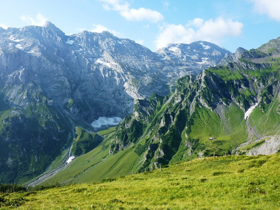
1. Tag bis Surenen Pass - Engelberg - Jochpass - Melchsee
2. Tag Meiringen - Grosse Scheidegg
3. Tag Grindelwald - Lauterbrunnen - Sefinanfurgge - Gorneren - Naturfreundehaus
4. Tag Hohtürli - oeschinensee - Kandersteg - Hotel Schwarrenbach
5. Tag Gemmipass - Leukerbad - Restipass - Rhonetal
6. Tag Rhonetal - Lötschberg Südrampe - Aletsch Geltscher
7. Tag Rhonetal Grimsel Pass
8. Tag Furka - Altdorf
Soweit die kurzen Eckdaten.
Wichtig bei dieser Tour:
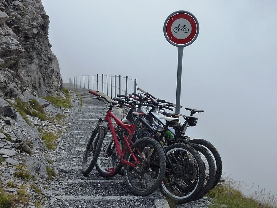
Begehen steiler Treppen und seilversicherter Passagen ist zwingend. Teilweise sehr ausgesetzt!
Schwere Fahrpassagen bis S4.
Gute Stirnlampe für die Befahrung der verschiedenen Tunnel am Lötschberg (bis 1 Km lang)
Der Gemmi Pass ist Schiebestrecke
Further information at
http://www.barbalex.ch/biketouren/mehrtagestouren/aletsch/Galeria trasy


Mapa trasy i profil wysokości
Minimum height 456 m
Maximum height 3658 m
More about the tour author
|
|
wige |
Komentarze
Nach Altdorf, dort zur Bergbahn. Am Parkplatz konnten wir ohne Probleme stehen bleiben.
GPS tracks
Trackpoints-
GPX / Garmin Map Source (gpx) download
-
TCX / Garmin Training Center® (tcx) download
-
CRS / Garmin Training Center® (crs) download
-
Google Earth (kml) download
-
G7ToWin (g7t) download
-
TTQV (trk) download
-
Overlay (ovl) download
-
Fugawi (txt) download
-
Kompass (DAV) Track (tk) download
-
Karta trasy (pdf) download
-
Original file of the author (gpx) download
More about the tour author
|
|
wige |
Add to my favorites
Remove from my favorites
Edit tags
Open track
My score
Rate
Super Tour
- fand die Tour einfach genial.
+ Wasserleitungswege
+ Aletschgletscher
+ super Trails